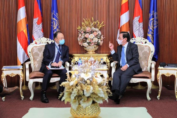
Australia gifts eWater Source to Cambodia

In a special ceremony in Phnom Penh, Australia’s Ambassador to Cambodia, His Excellency Pablo Kang formally gifted access to Australia’s national water modelling platform, eWater Source to Cambodia’s Minister of Water Resources and Meteorology (MOWRAM) His Excellency Lim Kean Hor. 

This technical exchange forms part of Australia’s ongoing support for sustainable water management throughout the Mekong region.

eWater Source, Australia’s national hydrological modelling platform will assist the Cambodian Government to better understand the availability of water resources throughout the country. It will provide a stronger evidence base on which to make decisions about the development of water infrastructure and the allocation of water for a range of users – cities and towns, farming and freshwater fisheries, hydropower and industry.

“The sustainable management of Cambodia’s precious water resources is crucial to support the socio-economic development of our cities and of our growing agriculture and energy sectors, while preserving our unique environment” stated His Excellency Lim Kean Hor.

“We welcome the offer by the Government of Australia to provide both technical tools and capacity building support so that Cambodians can learn from the Australian experience and improve our management of water resources for the entire country.”

In response, Ambassador Kang said “We are pleased to share an important Australian innovation – the eWater Source platform –with our neighbours and friends in Cambodia, because doing so will help ensure water governance is based on solid evidence and can contribute to Cambodia’s post-COVID recovery”

eWater has worked with the Mekong River Commission (MRC) its member countries (Cambodia, Laos, Thailand and Vietnam) for many years. Starting in 2013, eWater developed a Source model of the entire Mekong River and major tributaries, ultimately leading to eWater contributing to the 2018-19 MRC Council Study using Source to integrate information and existing basin models.  

In 2017-19, eWater, in partnership with UNESCAP, Geoscience Australia and the Australian Bureau of Meteorology implemented a pilot in Cambodia using space-based data to help water users in drought prone countries to better understand and manage droughts.  eWater provided updated technology and access to satellite data through the Geoscience Australia Open Data Cube to improve the ESCAP Regional Drought Mechanism.  In 2019 eWater was appointed as an adviser to MOWRAM in Cambodia under a World Bank project.  


Integrated Water Resources Management in Lao PDR

Water is essential to life and culture in the People’s Democratic Republic of Lao. More than third of GDP and 75% of employment comes from subsistence agriculture, which is heavily dependent on rainfall and Lao’s rivers.

Traditionally, the People’s Democratic Republic of Lao (Lao PDR) was considered a water rich country, but increasing demand for water, especially in the dry season is putting pressure on water resources. Climate change is also affecting the region, with water quality impacted by rising temperatures and water infrastructure at risk from increased flash flooding.

In response, the Government of Lao PDR is implementing a series of water reforms, including developing a National Water Resources Strategy and Action Plan 2016-2020 and major amendments to the Water and Resources Law were approved in 2017. The new law focuses on better protection of water resources and sustainable use to support national economic development.

Supporting these reforms is the World Bank funded Mekong Integrated Water Resource Management (MIWRM) program, which seeks to establish good examples of integrated water resources management practice at the local, regional and river basin scales.

Landscape view over Xe Don river in Pakse, Laos (credit: Marek/AdobeStock)

The project

eWater was engaged under the MIWRM program to support the Lao PDR Natural Resources and Environment Research Institute (NRERI) Hydrological Modelling Unit to build its capability to develop and apply water models for water resource assessment, sustainable water management and to support policy and investment decision making.

Surface water resource models for four basins; Xe Bang Fai, Xe Bang Hieng, Xe Don and Xe Kong were built and calibrated using the eWater Source platform. The models were used to evaluate:

  • total water availability from surface runoff
  • inter-basin water transfers
  • water demands and consumption for domestic, industrial and agriculture users
  • hydropower operations and production.

Water supply and demand were summarised on a monthly basis and the impacts of water resource development on natural flow patterns were evaluated.

In addition, to understand the relative impacts of different water resources development options in the Xe Kong basin, four development scenarios were assessed:

  1. current (2017) conditions
  2. hydropower development
  3. irrigation development
  4. combined development.

Each scenario was evaluated under historical climate conditions and a climate change scenario. This initial assessment seeks to demonstrate the power modelling can bring to the decision-making process and inform the development of a later detailed scenario assessment.

Overcoming data constraints

Traditionally, good water modelling relies on high-quality, measured data. However, such data is often uncommon in countries such as Lao PDR. To address this, much of the data used in the modelling came from global, remotely sensed data sets, calibrated against the limited measured data.

Despite the limited measured data, good calibration was achieved in all four basins, demonstrating that the Source model platform is an effective tool for low-data environments. Importantly, Source has the ability to incorporate additional data as it becomes available, progressively increasing reliability and accuracy over time. 

Implementation

The project has helped to increase the capacity of water managers in Lao PDR to build and use water models. The four models build for the project give water managers vital information and new tools for responding to emerging water management challenges, such as:

  • annual and seasonal water availability
  • annual and seasonal water flow patterns, and how these vary from natural conditions
  • annual and seasonal water usage
  • actual and potential water shortages
  • hydropower demands and impacts on flow patterns and water balance

Example outputs from the model are shown in the figures below, they provide easy to understand, practical information to guide decision making.

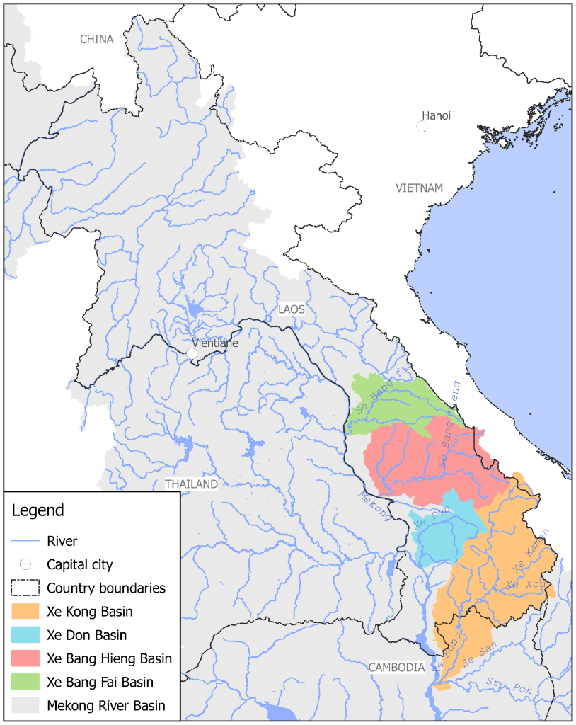
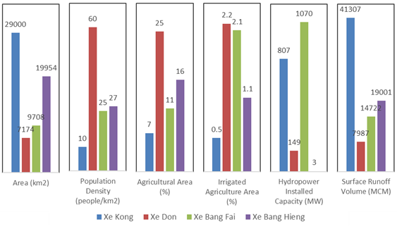
Summary of basin characteristics.
NB: For Xe Bang Fai the installed capacity represents the NamTheun 2 hydropower project, which is located outside of the basin and diverts water into the basin.
Summary of average annual water demands and the deficit in supply (represented as negative values) for the four basins.

Capacity building 

Building the capability of the NRERI Hydrological Modelling team was a core focus of the project. eWater provided tailored Source training and worked closely with the team in building the four models and developing the scenarios to be tested.

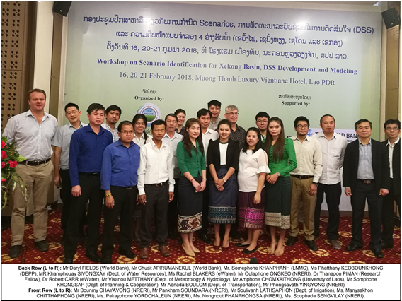
Participants at a workshop to develop scenarios for the Xe Kong basin. Attendees were from NRERI, other Lao PDR government agencies, the World Bank and eWater