Vandana Thakur, Software Tester, visits Canberra primary school to share STEM experience with future leaders
It is not often we get the opportunity to talk to young people about the work we do and the role we play in the water sector but when it does happen it reinforces why we work at eWater Group.
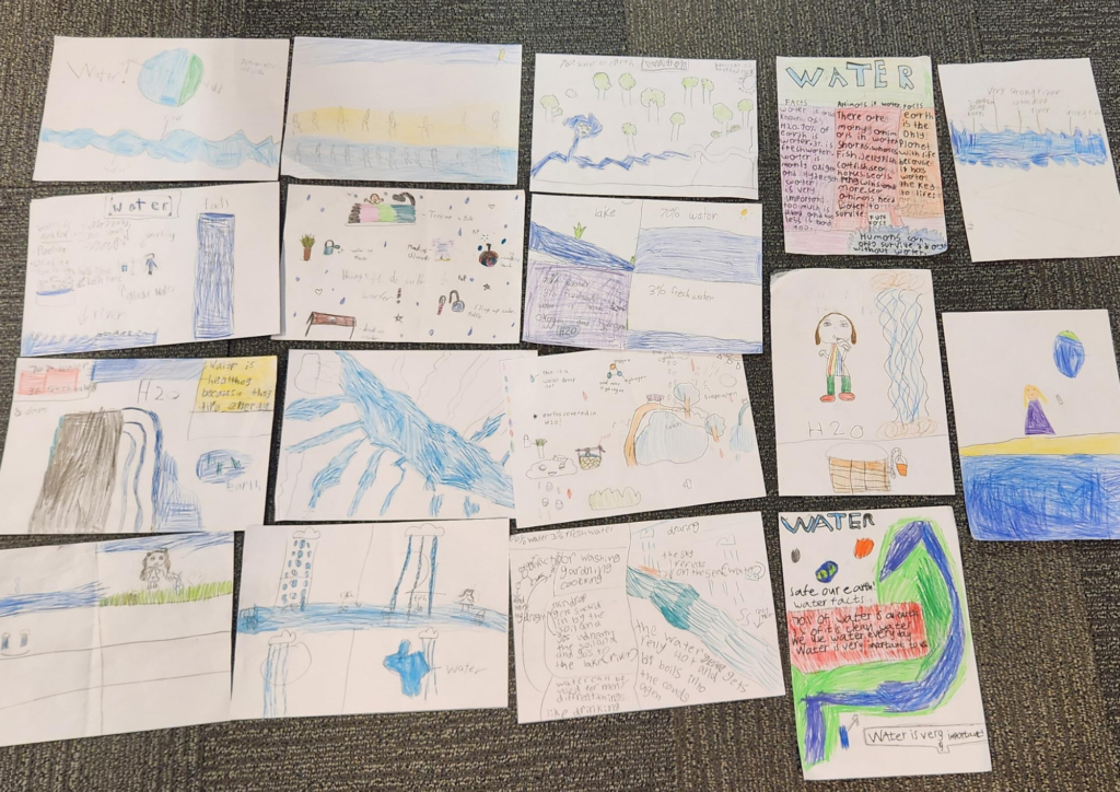
Vandana Thakur, our Software Tester, recently visited Garran Primary School, Canberra, and met with students as part of a STEM activity where a cohort of people shared their roles and why they do it. Vandana was joined by representatives from our Australian Deference Forces, a physicist, pathologist, and a solar energy specialist.
For Vandana it was the opportunity to share why she works at eWater Group and how her role is helping to provide creative, science-based and trusted water management expertise and tools within Australia and internationally.
As part of her visit, students took part in a drawing competition to understand the importance of protecting our water resources, the role of eWater Source™, Australia’s National Hydrological Modelling Platform, and how everyone has a part to play.
Congratulations to all the students and thank you to Garran Primary School for inviting us to share our story.
Sharing Australian water expertise, globally
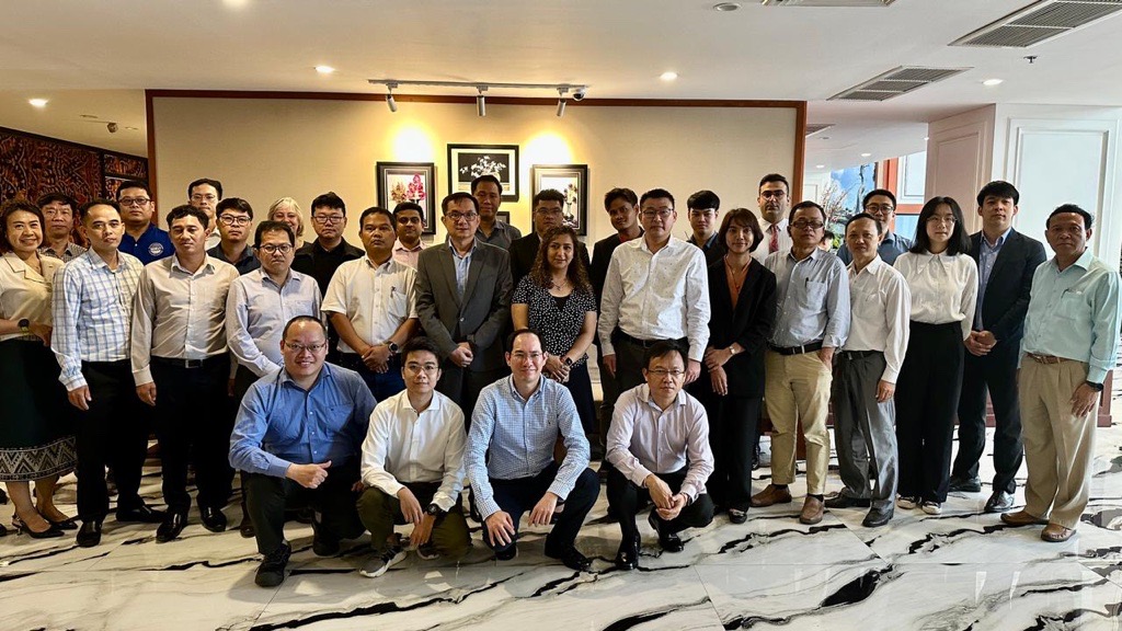
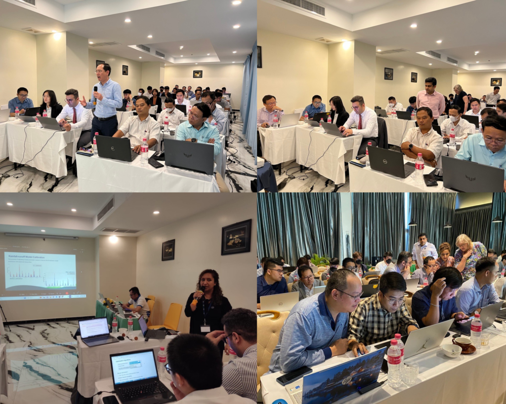
Our Hydrology team recently joined experts in the Mekong region for a regional training modelling tools program.
Sharing best practices, capabilities, and knowledge of Australian water expertise globally is our mission at eWater Group.
Our people – across eWater Solutions, the Australian Water Partnership, and Mekong Water Solutions – work incredibly hard in the pursuit of sustainable management of water resources.
Members of our Hydrology team – Juanita Moolman, Paradis Someth, Samira Azadi, and Sudeep Nair – recently joined experts from six Mekong countries to run a regional training modelling tools program as part of a joint study.
The Lancang-Mekong Cooperation (LMC) and the Mekong River Commission (MRC) are conducting a joint study on the changing hydrological conditions of the Lower Mekong River Basin. The study aims to develop adaption strategies that address the flooding and drought risks caused by climate change across the river basin.
Paradis Someth, Principal Hydrologist, eWater Group, said “As part of the study, our eWater Group Hydrology Team joined by water modelling experts from across the Mekong region to provide hands-on training and expertise on using, eWater Source to gain a better understanding of this tool and how it can help in impact assessment.”
“eWater Group has a long and proud history of supporting water resource management in the Mekong region. eWater Group’s three divisions – eWater Solutions, Australian Water Partnership, and Mekong Water Solutions – play a critical role in shaping Australia’s technology and helping to build capabilities in the region.”
Australia has been a partner of the Mekong River Commission (MRC) since its inception in 1995. The MRC is an intergovernmental organisation, established “to help the lower Mekong countries build consensus around solutions that ensure a sustainable future for the Mekong and its people through river basin monitoring, assessment, data and information sharing, and dialogue and cooperation.”
Since 2013, eWater Group has supported the MRC and its four member countries (Cambodia, Laos, Thailand, and Vietnam) to enhance the management of the Mekong River’s water for the benefit of all who depend on it.
by Damien Pearson, General Manager, eWater Solutions
Climate change is one of the defining challenges of this century.
Water is the primary expression of the effects climate change has on humanity and the environment manifesting itself through droughts, floods, water stress, and declining water quality. In many countries reliable supplies of freshwater are becoming scarce, undermining economic growth, increasing poverty, placing vulnerable people at risk and further disadvantage, and damaging the environment on which all life depends. The “livelihood crises” caused by the climate crisis have been identified by the World Economic Forum as “one of the most potentially severe risks over the next decade.” [i]
Effective management of water resources in the face of changing climate is essential to achieving all 17 of the United Nations Sustainable Development Goals agreed by all nations in 2015.
How Australia can make a difference
As the driest inhabited continent on earth, Australia has become an internationally recognized leader in water policy and management.
Our sought-after expertise includes advice on transparent water allocation systems, efficient irrigation practices, and technologies, drought mitigation measures, allocation of environmental water flows, as well as reforms in urban water and sanitation.
Importantly in the context of climate change, Australia’s reforms include an explicit focus on economic efficiency and environmental sustainability.[i] However, Australia is a continent with many different climate zones and many different water use profiles.[ii]
Consequently, Australian states and territories have had to develop water governance frameworks appropriate to their climate and environmental contexts while maintaining content and coherence with national plans and agreements. One size does not fit all.
eWater Source, Australia’s agreed National Hydrological Modelling Platform (NHMP), supports integrated planning, operations, and governance from urban to catchment to river basin scales including taking human and ecological influences into account. Source accommodates diverse climatic, geographic, water policy and governance settings for both Australian and international climatic conditions.
Our platform integrates water resource assessment and policy, to produce water accounts and manage rivers, and share water according to allocations and agreements.
eWater Source has become an important tool for understanding water supply and demand, managing allocations between users, and delivering water when and where it is needed.
Designed to be adaptive and readily customized to meet local or specific needs, eWater Source is underpinned by world-class science and technical innovation, and assists in the following broad areas:
Assessing climate change impacts on water availability and demand over time
Establishing effective water policies, regulatory systems, and institutions to enable infrastructure investments (governance policies and systems)
Collecting and managing water data and developing water information systems
Enabling water allocations and management of river basins and urban water supply
eWater Source has been applied and validated extensively in a wide range of real-world water use situations, both in Australia and internationally, supporting the management of rivers in Australia, the Mekong region, across South Asia, Africa, and the Middle East.
Growing urban demand
Our world is rapidly becoming more urbanized. In 2018, 55 percent of the world’s population was living in urban areas, a proportion that is expected to increase to 68 percent by 2050. Projections show that urbanisation, combined with the overall growth of the world’s population could add another 2.5 billion people to urban areas by 2050, with close to 90 per cent of this increase taking place in Asia and Africa, according to United Nations data set[1].
With a growing focus on meeting a more spatially concentrated water demand, planners require tools to understand their water supply and drainage options and constraints, along with means to assess alternative scenarios to manage these. Water-sensitive urban design (WSUD) seeks to blend traditional rainfall-dependent and alternative water supplies (such as recycled water, and rainwater tanks) to enhance water security.
To understand this blend of supplies and potential trade-offs, eWater MUSIC and Urban Developer models are designed to manage the interaction between various water supply systems as well as capture all water cycle components including rainfall and stormwater runoff, potable water, and the recycling / reuse of wastewater. These tools enable robust and reliable decision-making for secure urban water supplies.
Climate Change is exacerbating the water scarcity crisis through changing weather patterns and increasing frequency and intensity of extreme weather events. The water challenge has become “too much, too little, or too polluted”.
Climate change adaptation primarily demands climate-resilient water management and eWater is ready to share its experience and tools to assist countries facing persistent poverty and disadvantage resulting from the impacts of climate-driven water scarcity.
eWater Group is jointly established and owned by the Australian Federal and all State and Territory governments to maintain and further develop Australia’s internationally respected water modelling tools, and to provide support, program delivery, and training domestically and internationally.
[ii] Productivity Commission, National Water Reform 2020, Inquiry Report. p68
Supporting Queensland’s next generation of water modellers
The Queensland Water Modelling Network (QWMN) aims to improve the state’s capacity to model its surface water and groundwater resources and improve the quality of it’s models.
Established by the Queensland Government in 2017, the QWMN provides tools, information and collaborative platforms to support best-practice use of water models and the uptake of their results by policy makers and natural resource managers. The QWMN encourages engagement between modellers, researchers, policy makers and resource managers.
A key focus of the QWMN is building Queensland water sector capability through its mentoring program. The program partners experienced modellers with university undergraduate students and young water professionals interested in water modelling, it The aims to:
Grow the size and capabilities of the Queensland water modelling workforce by building a pipeline of skilled and enthusiastic graduates who want to pursue water modelling careers in Queensland.
Expose students to ‘real world’ water policy issues so that they develop applied knowledge and become enthused about the work of water modellers.
Develop undergraduate student critical analysis and systemic understanding of how the outputs from water models are and can be used.
The program has two components. Firstly, students undertake online water model training and tutorials to become familiar with the relevant models and tools. Students then undertake a ‘real world’ modelling challenge, supported by mentors who are experienced Queensland Government modellers.
eWater is an active supporter of the mentoring program, providing access to the full version of Source, training materials and technical support for participants.
Phase 1 of the program has been successfully completed by students from Griffith University, James Cook University, University of South Queensland, Queensland University of Technology and University of Queensland and a young professional within the Queensland Department of Natural Resources Mines and Energy (DNRME).
Students used eWater Source to understand how water quality targets are set for the Great Barrier Reef catchments. The Cattle Creek sub catchment within the Mackay/Whitsunday region used in the challenge. Through the project, participants both learn how to use Australia’s National Hydrological Modelling Platform, eWater Source and are exposed the the challenges faced by both government and industry to meet the Great Barrier Reef water quality targets.
The program has since been extended to students at the universities of Central Queensland and the Sunshine Coast in 2020-21. The QWMN is also working to engage modelling experts from the private sector.
Paddock to Reef – Integrated Monitoring, Modelling and Reporting Program
Targeting investment to improve the health of the Great Barrier Reef.
What is the Paddock to Reef program?
The Paddock to Reef Integrated Monitoring, Modelling and Reporting Program (Paddock to Reef program) started in 2009 as a joint initiative of the Australian and Queensland governments to report on water quality improvement resulting from investment in improved land management practices. Improving the quality of water leaving properties by reducing pollutant run-off is critical to build the health and resilience of the Great Barrier Reef (GBR). The program brings together industry bodies, government agencies, natural resource management bodies, landholders and research organisations.
The program provides a framework for evaluating and reporting progress towards the Reef 2050 Water Quality Improvement Plan targets. It integrates monitoring and modelling information on management practices, catchment indicators, catchment loads and the health of the Reef at the paddock, sub-catchment, catchment, regional and whole GBR scales (image below). The program evaluates management practice adoption, management practice effectiveness (in terms of water quality benefits and economic outcomes), catchment condition, pollutant run-off and marine condition.
Focus areas for the Paddock to Reef program
How does Source support the program?
The catchment modelling for the program is based on the Source platform, with customised plug-ins developed by the Queensland Government to provide additional water quality functionality. A range of other purpose-built data collection and reporting tools have also been built to support the program. These include interactive maps to show pollutant generation rates and priority investment areas.
The models are primarily used to report on annual progress towards the reef water quality targets as a result of investment in improved land management practices. Model outputs are also used to determine priority areas for investment and to assess possible outcomes from different scenarios such as different rates of adoption of improved practices. The catchment models also provide inputs for the marine models.
The Paddock to the Reef program helps manage the impacts of landuse on the quality of water flowing to the Great Barrier Reef, Qld (credit: WITTE-ART.com / Adobe Stock)
Information sharing
Many of the actions required to achieve the water quality targets need to be undertaken by farmers and other land managers. To support greater uptake of the required actions, the Paddock to Reef program has been designed to share technical information in a way that can be easily understood and used. It also incorporates the local knowledge of land managers. Program features include:
Multiple lines of evidence to inform progress towards the targets.
Technical experts are based in the regions, giving them a good understanding of the local environment, issues and the effectiveness of management actions. This also helps build relationships with local land managers.
Ongoing refinement of the models and other tools to incorporate new knowledge, data and methods.
Results are presented online through an interactive reporting system to cater for the broad range of stakeholders interested in the results from the general public to scientific experts.
Data is made available to support other programs, for example regional report cards and regional natural resource management body and local government investment decisions.
‘Cut down’ models provide locally specific tools to assess individual projects and prioritise local investment.
Peer review, continual improvement and validation are critical elements for any modelling program. The Paddock to Reef catchment modelling program undertakes an external review every three years. The program is supported by a GBR-wide pollutant loads monitoring program which provides data to calibrate and validate the catchment models and increase confidence in the models over time.
This case study was prepared in collaboration with the Queensland Department of Environment and Science.
Integrated Water Resources Management in Lao PDR
Water is essential to life and culture in the People’s Democratic Republic of Lao. More than third of GDP and 75% of employment comes from subsistence agriculture, which is heavily dependent on rainfall and Lao’s rivers.
Traditionally, the People’s Democratic Republic of Lao (Lao PDR) was considered a water rich country, but increasing demand for water, especially in the dry season is putting pressure on water resources. Climate change is also affecting the region, with water quality impacted by rising temperatures and water infrastructure at risk from increased flash flooding.
In response, the Government of Lao PDR is implementing a series of water reforms, including developing a National Water Resources Strategy and Action Plan 2016-2020 and major amendments to the Water and Resources Law were approved in 2017. The new law focuses on better protection of water resources and sustainable use to support national economic development.
Supporting these reforms is the World Bank funded Mekong Integrated Water Resource Management (MIWRM) program, which seeks to establish good examples of integrated water resources management practice at the local, regional and river basin scales.
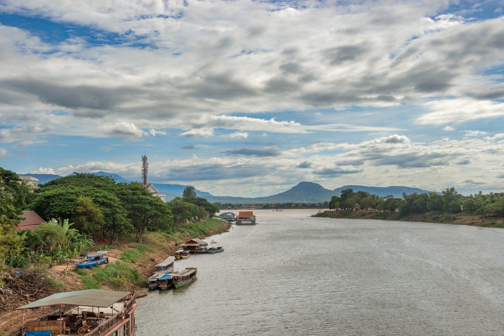
Landscape view over Xe Don river in Pakse, Laos (credit: Marek/AdobeStock)
The project
eWater was engaged under the MIWRM program to support the Lao PDR Natural Resources and Environment Research Institute (NRERI) Hydrological Modelling Unit to build its capability to develop and apply water models for water resource assessment, sustainable water management and to support policy and investment decision making.
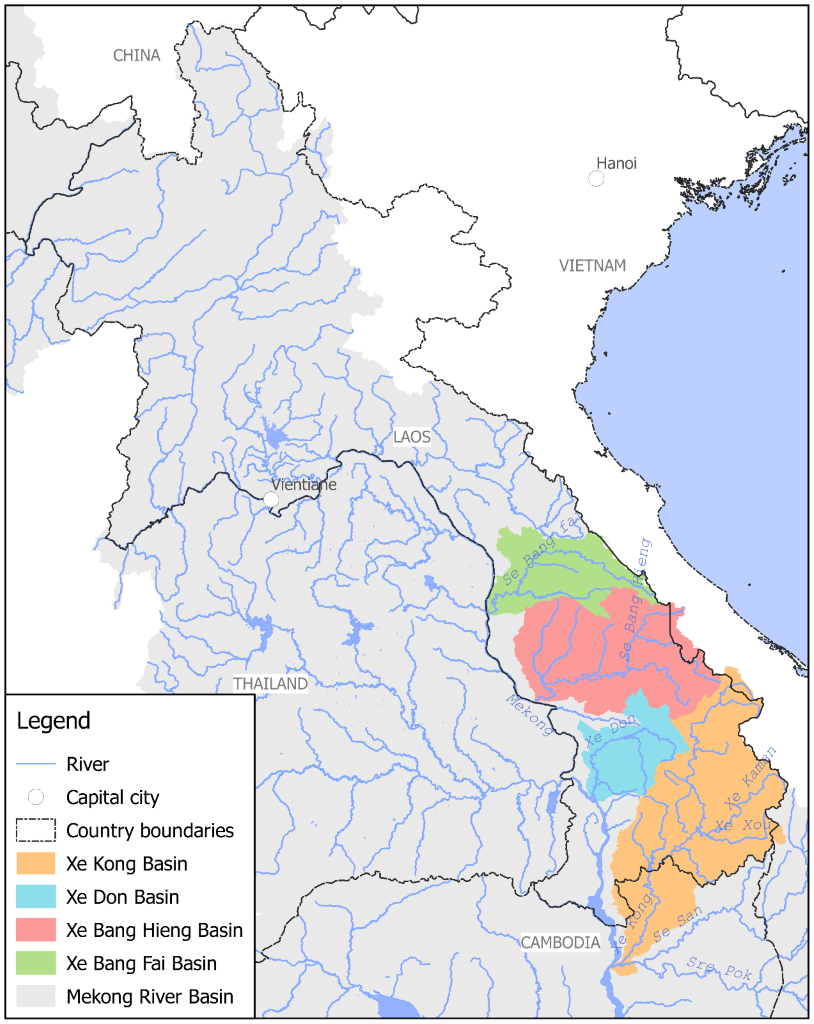
Surface water resource models for four basins; Xe Bang Fai, Xe Bang Hieng, Xe Don and Xe Kong were built and calibrated using the eWater Source platform. The models were used to evaluate:
total water availability from surface runoff
inter-basin water transfers
water demands and consumption for domestic, industrial and agriculture users
hydropower operations and production.
Water supply and demand were summarised on a monthly basis and the impacts of water resource development on natural flow patterns were evaluated.
In addition, to understand the relative impacts of different water resources development options in the Xe Kong basin, four development scenarios were assessed:
current (2017) conditions
hydropower development
irrigation development
combined development.
Each scenario was evaluated under historical climate conditions and a climate change scenario. This initial assessment seeks to demonstrate the power modelling can bring to the decision-making process and inform the development of a later detailed scenario assessment.
Overcoming data constraints
Traditionally, good water modelling relies on high-quality, measured data. However, such data is often uncommon in countries such as Lao PDR. To address this, much of the data used in the modelling came from global, remotely sensed data sets, calibrated against the limited measured data.
Despite the limited measured data, good calibration was achieved in all four basins, demonstrating that the Source model platform is an effective tool for low-data environments. Importantly, Source has the ability to incorporate additional data as it becomes available, progressively increasing reliability and accuracy over time.
Implementation
The project has helped to increase the capacity of water managers in Lao PDR to build and use water models. The four models build for the project give water managers vital information and new tools for responding to emerging water management challenges, such as:
annual and seasonal water availability
annual and seasonal water flow patterns, and how these vary from natural conditions
annual and seasonal water usage
actual and potential water shortages
hydropower demands and impacts on flow patterns and water balance
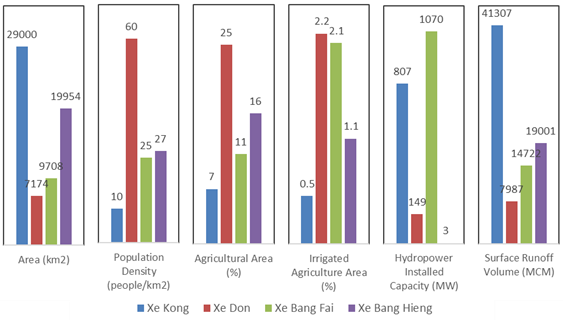
Example outputs from the model are shown in the figures below, they provide easy to understand, practical information to guide decision making.
Summary of basin characteristics. NB: For Xe Bang Fai the installed capacity represents the NamTheun 2 hydropower project, which is located outside of the basin and diverts water into the basin.
Summary of average annual water demands and the deficit in supply (represented as negative values) for the four basins.
Capacity building
Building the capability of the NRERI Hydrological Modelling team was a core focus of the project. eWater provided tailored Source training and worked closely with the team in building the four models and developing the scenarios to be tested.
Participants at a workshop to develop scenarios for the Xe Kong basin. Attendees were from NRERI, other Lao PDR government agencies, the World Bank and eWater
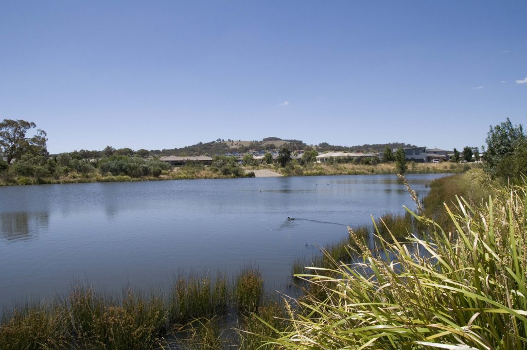
Using Source for water and catchment management in the Australian Capital Territory
Source models support strategic planning, policy development, catchment and water resource management in the Australian Capital Territory
The models underpin the Australian Capital Territory (ACT) Water Strategy 2014-44 – Striking the Balance and support the ACT Government to meet its obligations under the Murray-Darling Basin Plan 2012.
Together with eWater, the ACT Environment, Planning and Sustainable Development Directorate (the Directorate) have embarked on a series of initiatives to upgrade the ACT’s Source models.
Improving water quality through wetlands like this is one in the Canberra suburb of Bonner is a central part of the ACT Water Strategy (credit: Danswell Starrs, ACT Environment, Planning and Sustainable Development Directorate)
Audit of water models
The Directorate use several different Source models to inform strategic planning and decision-making regarding land use planning, urban development and climate change on water quantity and quality and the operation and maintenance of water infrastructure.
eWater was engaged to audit the Directorate’s existing Source models to ensure they were fit-for-purpose and could address emerging needs, including the ability to:
explore different policy, planning and management actions and assess potential impacts on the natural environment and water resources
predict impacts of land development decisions on water resources and assess mitigate measures
test new ways of operating water infrastructure
predict future environmental states to inform policy and management decisions, such as environmental condition and future water supply/catchment yields.
The audit identified several issues with the existing models that limited their ability to meet the current and future needs of the ACT Government. eWater recommended a substantial rebuild of the models, including:
Consolidating the existing nine models.
Utilising human-readable input sets and data sets to run scenarios, rather than individual models.
Reconfiguring storages and lakes in the catchment model to better represent how they operate.
Reconceptualising and recalibrating the rainfall-runoff models.
Incorporating the ACT water supply system.
Establishing a current conditions baseline case for scenario assessment.
Preparing and justifying a baseline scenario for the comparison of land use change scenarios.
Model rebuild
Following on from the audit, eWater was engaged to rebuild the ACT’s catchment and planning models.
eWater built two new Source models for the ACT, a catchment and a planning model. Model performance has been improved by reducing the number of sub-catchments outside of the ACT. The new models use LASCAM (Large-Scale Catchment Model) rainfall-runoff models, allowing for physically based assessments of hydrological impacts of land use change. The catchment model now incorporates Canberra’s water supply system, including storages. The consolidation of the models allows for different policy and management options to be implemented by Scenario Input Sets.
In addition to the model re-build, the project also included collaborating with the ACT Office of the Chief Digital Officer to the integrate Source models with the ACT Government Water Data Management System. This brings two main benefits, it streamlines the transfer of data and model outputs and adds dashboarding capabilities to improve the presentation of model outputs. Integrations was achieved through a customised plug-in, developed by the eWater Software Development Team.
eWater also provided customised training to Directorate staff, to ensure they understood the Source model and were able to support its future development and application.
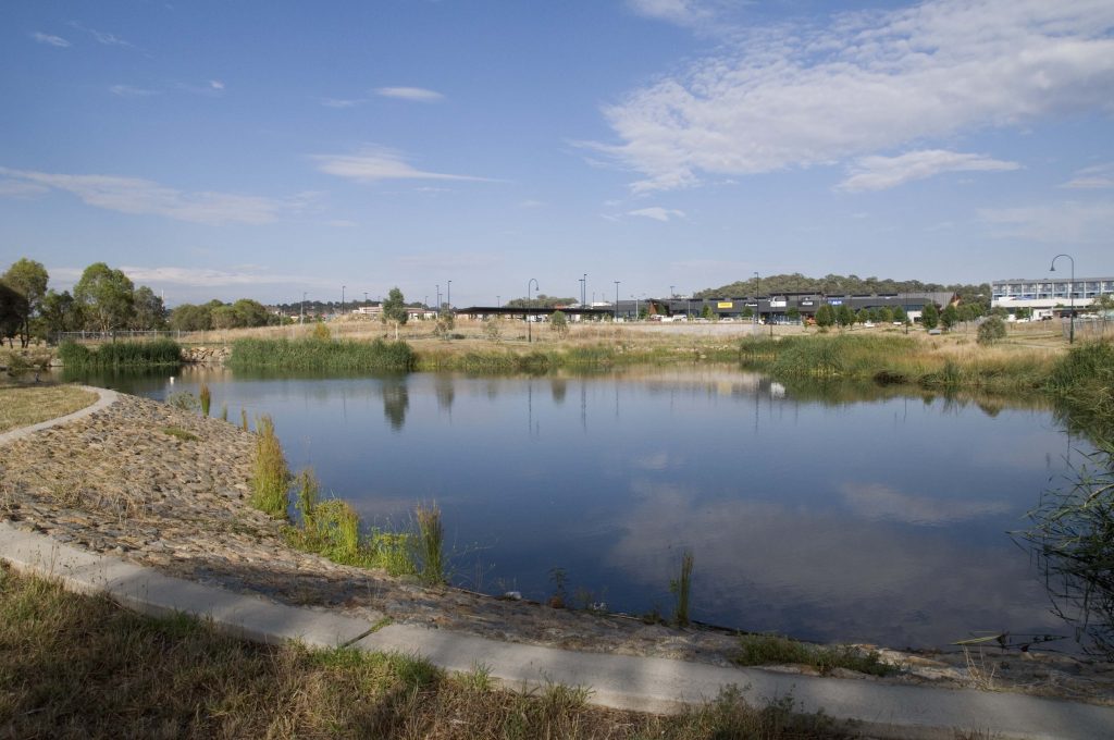
The updated models will support the ACT Government to better manage urban stormwater and flooding risks (credit: Danswell Starrs, ACT Environment, Planning and Sustainable Development Directorate)
Implementation
The Directorate is using the models to inform a wide range of water and catchment management activities, including to:
support investment in catchment remediation and
investment, by helping identify which areas will lead to the greatest
improvements in water quality and/or water yield
investigate Integrated Catchment Management
options across the ACT and the greater region
understand stormwater and flooding risks in
urban areas
forecast future water supply and demand
scenarios
compare likely outcomes from different water
efficiency initiatives
investigate alternative water supply options,
such as treated effluent, grey water and stormwater for consumptive and
non-consumptive uses
test different options to improve the management
of rivers and lakes, to promote recreational use and reduce risks to public
health.
Acknowledgements
This case study was prepared in collaboration with the ACT Environment, Planning and Sustainable Development Directorate.
River Basin Models and Water Sharing Policy in the upper Godavari Sub-Basin, Maharashtra, India
Resolving tension between farmers upstream and downstream over water allocations in the upper Godavari River in Maharashtra was the focus of a four year engagement in the west Indian State by eWater.
The Maharashtra and New South Wales governments signed a Memorandum of Understanding for cooperation across a wide range of issues. Under the provisions of this MOU, the Government of Maharashtra in partnership with the NSW Department of Industry, Lands and Water (then) engaged eWater to provide training, technology transfer, and ongoing support in the use of Australian river modelling technology to Maharashtra.
eWater assisted the Maharashtra Department of Water Resources to develop a modelling framework to test water management options and to support the development of an integrated water resources management (IWRM) plan for the Upper Godavari sub-basin.
Basin overview
The Godavari River basin is India’s second largest river basin, it covers 50% of the land area of Maharashtra state. It is a complex system, with 20 dams. Water use includes irrigated crops, industry and domestic use in urban and rural areas, including drinking water. Water availability and equitable distribution of water within the sub-basin are major public concerns that have resulted in legal challenges.
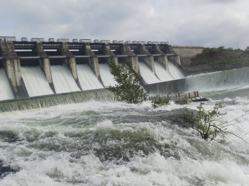
Within the sub-basin there is significant spatial and inter-annual variability in monsoon rainfall. Typically, runoff is generated in the high-rainfall, high-elevation areas of the sub-basin with little runoff generation in the area near the large Paithan irrigation dam at the outlet of the Upper Godavari.
Paithan Dam, after upstream monsoon rains.
Project outcomes
The project had two primary outputs, a calibrated Source model for the Upper Godavari Sub-Basin and building the capacity of the Maharashtra Department of Water Resources.
eWater, in collaboration with modellers from the Maharashtra Department of Water Resources set-up and calibrated a Source model for the Upper Godavari sub-basin. The model was used to evaluate water management options to improve equitable access to water across the sub-basin. Model outputs were used to inform the integrated water resource management plan
eWater and the NSW Department of Industry, Lands and Water used outputs from the river basin models to establish and focus communication and discussion with the Maharashtra Water Resources Department about improved water management policies and governance processes to implement the objectives of the Maharashtra State Water Policy. With a key focus being improving targeted communications to farmers in the basin.
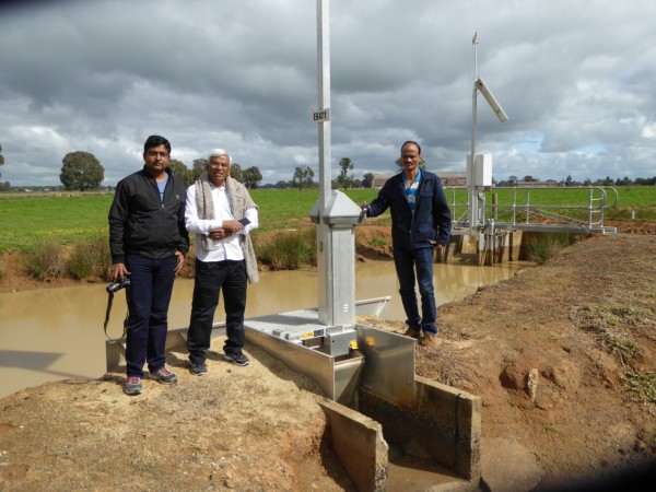
eWater delivered a comprehensive training program in the use of Source, with customised training based on the Upper Godavari model. Training was held in India and Australia, both involved a combination of hands-on desktop learning and field visits to better understand the linkages between models and on-ground water management.
More broadly, the project brought together water managers, academics and researchers in the Upper Godavari sub-basin to establish a community of practice that allows lessons and experiences to be shared across other sub-basins in Maharashtra.
Delegates learning about modern irrigation technology in the Murray-Darling Basin.
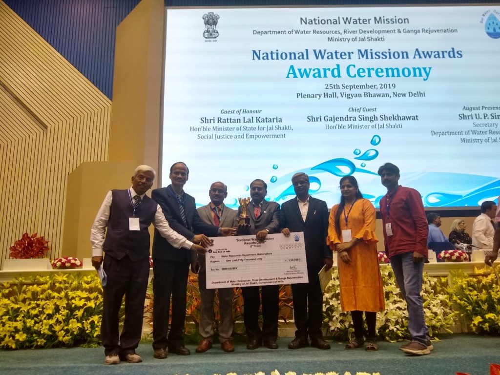
Award winning project
The success of the project was recognized at India Water Week 2019, when the national Minister for Jal Shakti (Water Resources) presented an award to the Maharashtra Water Resources Department (WRD) for using eWater Source modelling framework to achieve equitable distribution of water in the Upper Godavari Sub-basin.
Left to right: Mr Arun Ghate (IWRM team GMIDC), Mr Jasing Hire (IWRM team GMIDC), Mr Ajay Kohirkar (Executive Director GMIDC), Mr Dilip Tawar (Chief Engineer GMIDC), Mr Rajendra Pawar (Secretary Command Area Development, WRD), Ms. Sonali Nagargoje (IWRM team GMIDC), Mr. Avirat Chavan (IWRM team GMIDC)
Melbourne Water – Improving water security with Integrated Water Resource Management
For 130 years Melbourne’s catchments and water infrastructure have provided for the water needs of Melbourne’s growing population and industry.
Population growth and climate change are putting increasing pressure on Melbourne’s traditional water supplies. Melbourne Water is working with retail water company customers to adopt a more integrated approach to delivering water services, with the aim of a city that is water sensitive, sustainable and liveable.
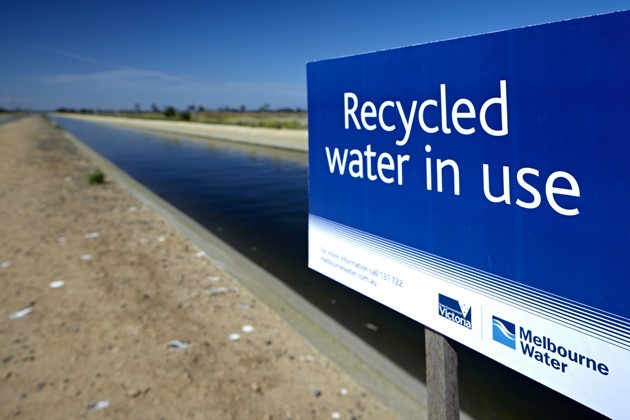
By adopting an Integrated Water Resource Management (IWRM) approach, Melbourne’s water companies are investing in a range of present or future innovative water management options, at the household, street, and suburb development scale, including:
recycling and reusing wastewater for things like agriculture, firefighting and dual-pipe systems that provide recycled water to homes and businesses for non-potable use like toilet flushing and watering gardens
recycling wastewater on site
capturing more stormwater for watering parks and sporting fields
refilling groundwater aquifers with stormwater or recycled water, for later extraction and use or to support natural environments
The IWRM approach requires a complete rethinking of the analysis of water system management. Traditional water system models are limited in their ability to analyse IWRM. Recognising this, Melbourne Water, with the support of eWater, has undertaken significant work to modernise their water resource models and to develop new tools to assess the benefits of IWRM.
Melbourne Water is increasing its use of recycled water
A new approach to water resource modelling
Work has focused on three key areas:
upgrading the bulk water supply infrastructure (headworks) model
integration with local water supply and demand models
new tools for improving model performance.
Source Headworks Model
For the past 25 years, Melbourne Water has used the REALM (REsource ALlocation Model) Headworks System Simulation Model. The REALM model runs on a monthly time step and is used mostly for long-term water planning. Traditional monthly timestep water resource models like REALM focus on the behaviour of the centralized bulk water supply system and have limited ability to address emerging modelling needs, such as:
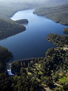
Maroondah Reservoir Melbourne Water is reducing its reliance on traditional water supplies.
To what extent can small scale alternative water sources, such as greywater, recycled water or stormwater, be utilized?
What is the best mix of centralized and decentralized supply options?
How will water use change with different policy options or new approaches?
Where are the best locations for, or uses of decentralized systems?
How to leave more water for healthy river flows and reduce stormwater pollution ?
Working with eWater, Melbourne Water is in the process of replacing the REALM model with a Source model. The new model can run on both a monthly and a daily time step and includes headworks infrastructure and water supply catchments. Catchments have been added to give a better assessment of both the amount of water flowing into the reservoirs and the quality of that water. This will be important for understanding the impacts of changes in the catchment, for example after bushfires or how climate change might impact runoff and streamflows.
The monthly time step mode has been kept to support long-term water management decisions, with important improvements, including customised water allocation rules to determine allocations for primary entitlement holders, such as the water retailers and new optimization tools help assess operating strategies, to find the optimal trade-offs for different management objectives, such as cost and security of supply.
The daily time step mode supports Melbourne Water to manage environmental water in the regulated streams and to meet streamflow requirements in unregulated streams. It also facilitates smaller scale IWRM modelling and helps to better understand the potential risks to water quality. Importantly, the model has been designed to easily switch from a monthly and daily time step, allowing for better integration between short, medium and long-term operating plans.
Headworks models are designed to find the best way to meet water demands and inform the reliability of water supply. As such the representation of demands in the model is equally as important as the representation of water supplies. An innovative feature of the new model is the incorporation of spatial geographic data to better understand demand. Spatial data includes population data, dwelling types and land-use. Ultimately, it will help estimate changing water demand and the potential impact of alternate water supplies at the suburb scale.
Urban Developer in Source
The upgrades to the headworks model bring a wealth of new features to support IWRM but they do not fully take into account potential alternative water supplies, such as rainwater, stormwater and wastewater, or localized demands. A second component of the project has been to incorporate eWater’s Urban Developer tools into the Source platform. This allows local small scale water sources and demands to be considered in the context of overall large scale supply options.
Urban Developer can now estimate urban water demands based on a suburb’s characteristics and how they might change, for example with population growth, dwelling type, the adoption of Water Sensitive Urban Design approaches or alternative water supplies like rainwater tanks. The approach was tested across four catchments and the model calibrated for the Melbourne region. The Urban Developer plugin to Source was developed to feed the outputs of the Urban Developer demand model into the Source Headworks Model.
An important aspect of the work was looking for more sophisticated ways to estimate demand and to differentiate between indoor/outdoor water use, and commercial and industrial water use. For example, we can now test if including information on household income or lot size provides more accurate water use estimates.
The Source Urban Developer plugin allows detailed analysis of urban water use
Improving model performance
Running large, complex models for different scenarios takes a lot of computing power and time. Melbourne Water uses optimization tools to inform water resource decisions by assessing how to maximise the reliability of supply and reduce delivery costs. With the enhanced model functionality, it would take a month to process Melbourne Water’s optmisation runs on a standard computer, even longer if new requirements, such as environmental flow delivery and integrated demand management options were included.
Working with eWater, a cloud-based run manager was set up to enable large numbers of simulations to be run across hundreds of virtual machines. A common web browser interface gives access to different run locations, including a local (single PC) and the Cloud (hundreds of virtual machines). Run times have been reduced to a number of hours.
In addition to saving time, the system is easy to install and use, does not require specialist knowledge and reduces the costs associated with owning and maintaining significant amounts of hardware. A particular advantage is that jobs can be tested locally before launching on the cloud, reducing the risk of minor errors negating the final results and the modellers can continue working on other projects while the simulation is being run.
Following the initial success, work is underway to expand the type of jobs that can be run on the cloud and to make Source and the optimisation tool, Insight, more cloud friendly.
Conclusions
The project has delivered significant improvements to Melbourne Water’s modelling tools. Innovative projects like these require flexibility, new ways of thinking and a high degree of collaboration. eWater and Melbourne Water have worked closely together throughout the process, proposing and testing different methods, refining and adapting along the way. A key aspect was including Melbourne Water in the software development process and allowing them to work directly with eWater to scope and prioritise software improvements.
Using Australian water tools to develop new drought metrics for Cambodia
eWater, Geoscience Australia (GA) and the Australian Bureau of Meteorology (BOM) collaborated to pilot using space-based data to forecast streamflows and water availability.
With the support of the Australian Water Partnership, eWater, GA and the BOM worked with the United Nations Economic and Social Commission for the Asia Pacific (UNESCAP) to develop new metric’s for the their ‘Regional Cooperative Mechanism for Drought Monitoring and Early Warning in Asia and the Pacific’ (the Regional Drought Mechanism)
The project integrated three leading Australian tools for water management:
Australia’s National Hydrology Modelling Platform – eWater Source
GA’s Open Data Cube for accessing and managing space-based data
the BOM’s streamflow forecasting tools
The pilot project integrated the three tools, to develop streamflow and water availability forecasts from space-based data. Traditionally, such information requires significant on-ground data and complex analysis tools. The pilot highlights the potential of the integrated suite of tools to significantly increase the information available to water and agricultural managers and farmers to anticipate and plan for drought conditions.
Further, the use of Open Data Cube technology enabled many Source model inputs to be generated automatically, reducing the time to build the model, potentially making modelling more accessible to water managers.
The information was made available in a relatively simple format and accessed through mobile technology via https://escap.ewater.org.au/
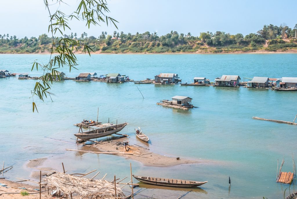
As this image shows, water levels in Cambodia are highlighly variable. Metrics such as those produced in the pilot provide more information to help Cambodian water managers and users adapt. (credit: simoscalise/ Adobe Stock)

 Summary of basin characteristics.
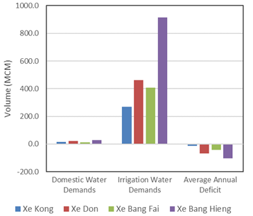
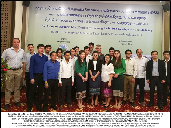 Participants at a workshop to develop scenarios for the Xe Kong basin. Attendees were from NRERI, other Lao PDR government agencies, the World Bank and eWater