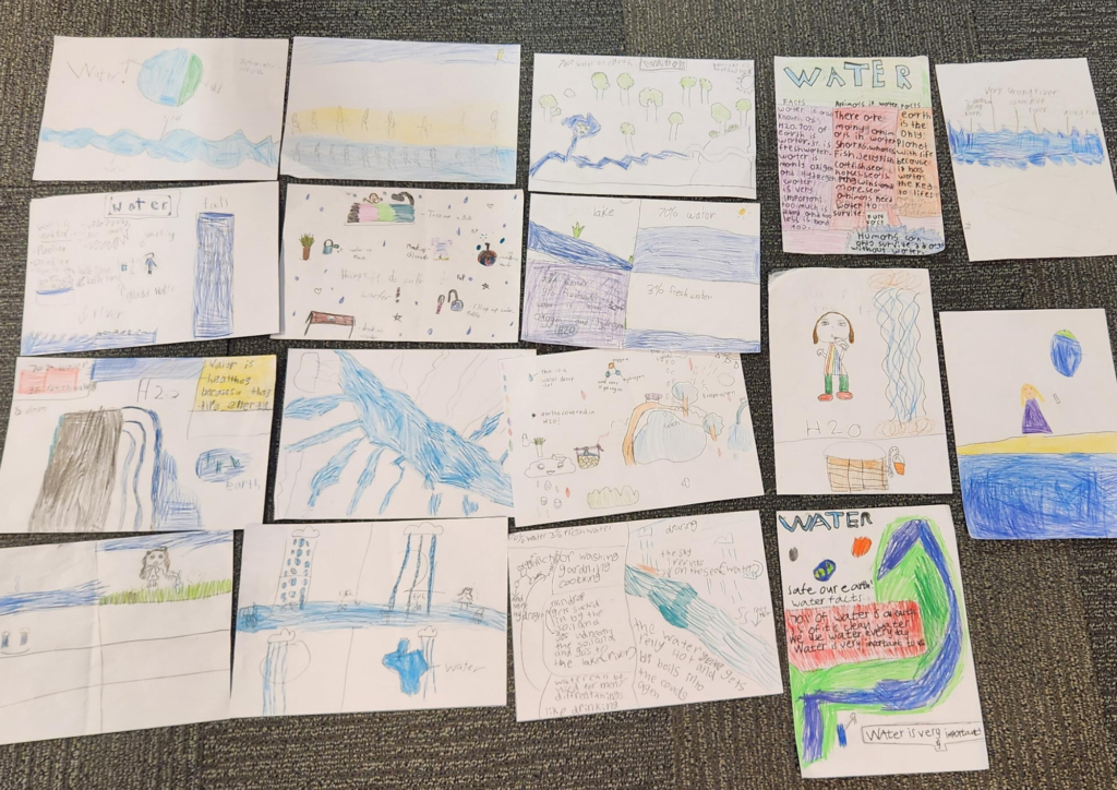
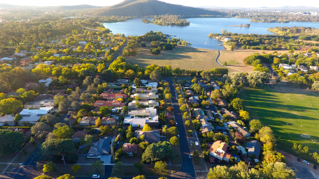
Vandana Thakur, Software Tester, visits Canberra primary school to share STEM experience with future leaders
It is not often we get the opportunity to talk to young people about the work we do and the role we play in the water sector but when it does happen it reinforces why we work at eWater Group.
Vandana Thakur, our Software Tester, recently visited Garran Primary School, Canberra, and met with students as part of a STEM activity where a cohort of people shared their roles and why they do it. Vandana was joined by representatives from our Australian Deference Forces, a physicist, pathologist, and a solar energy specialist.
For Vandana it was the opportunity to share why she works at eWater Group and how her role is helping to provide creative, science-based and trusted water management expertise and tools within Australia and internationally.
As part of her visit, students took part in a drawing competition to understand the importance of protecting our water resources, the role of eWater Source™, Australia’s National Hydrological Modelling Platform, and how everyone has a part to play.
Congratulations to all the students and thank you to Garran Primary School for inviting us to share our story.
World Environment Day
eWater Group recognises World Environment Day and the work of our people
Protecting and restoring land from the environmental demands and challenges it faces now and into the future is a key takeaway for World Environment Day today, and a core mission at eWater Group.
We are relied upon to provide creative, science-based, and trusted water management expertise and tools to meet Australian and international needs, and that includes giving back to our local communities, and protecting our environment.
In Australia and globally, our people develop, manage, and deploy tools and services than enhance the sound and responsible management of water, together with our international development program management capabilities in the pursuit of integrated water resource management objectives and poverty reduction.
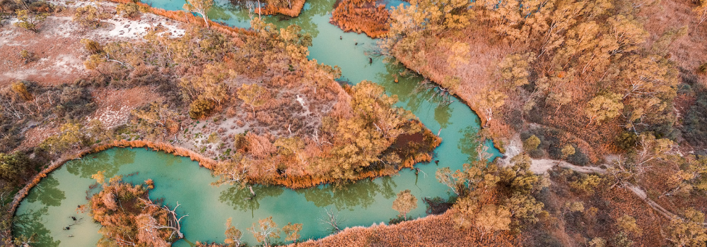
Locally, we have volunteered in our community by planting nearly 600 native trees on the Gudgenby River near the Namadgi National Park on the border of the ACT and NSW. The Gudgenby River faces significant pressure from increasing water temperatures, flash flooding, erosion, environmental weeds, and feral pests . Below is a before and after shot of our partnership with the Australian River Restoration Centre.
For us, World Environment Day is an opportunity to encourage conversation on this important issue but more importantly provoke action to protect our local waterways and those who depend on it in their communities, here in Australia or internationally.
If you want to learn how you can get involved with the Australian River Restoration Centre > https://arrc.au/
The Australian Government will invest $4 million in 2024-25 to commence essential upgrades to eWater Source.
eWater Group welcomes the announcement by the Australian Government to invest $4 million in 2024-25 to commence essential upgrades to the hydrological modelling software and technology underpinning sound decision making over the management of Australia’s surface water resources.
This investment is critical to the future of Australia’s National Hydrological Modelling Platform, eWater Source, and ensure we continue to deliver creative, science-based, and trusted water management expertise and tools to meet Australian and international needs.
Michael Wilson, Group CEO, “the investment of $4 million in 2024-25 in upgrades to Australia’s National Hydrological Modelling Platform, eWater Source, signifies a commitment by the Australian Government to deliver contemporary and responsive water management advice and support to meet the evolving changes, demands and challenges our environment is facing.”
“We are uniquely equipped to provide a consistent, reproducible, and trustable hydrological modelling and governance platform tailored to evolving water management needs, including the impacts of climate change.”
This investment will enable eWater Group to address and remove current limitations of the software for stakeholders and clients to access state-of-the-art technology and real-time monitoring, and analytics, and valuable insights to support water management advice, and support.
We will also undertake a scoping project to review our software and technology platforms for meet the growing and changing needs of our stakeholders.
This investment is essential for the future of eWater Source, ensuring ongoing development, support, and maintenance of Australia’s crucial hydrological modelling capabilities.
We will work closely with the Australian Department of Climate Change, Energy, the Environment and Water, together with state and territory governments, to improve water management and give decision-makers accurate, trustworthy information.
eWater Group is committed to the pursuit of the sustainable management of water resources through the sharing of best practices, capabilities, and knowledge nationally and globally.
National Reconciliation Day 2024
eWater Group recognises Reconciliation Day and continuing to foster collaboration with First Nations and their communities
eWater Group acknowledges Reconciliation Day as a time for all Australians to learn about our shared histories, cultures, and achievements, and how we all can contribute to achieving reconciliation in Australia.
As an organisation, we are committed to encompassing the experiences of First Nations people in all aspects of our work through better engagement and recognition of in the invaluable knowledge and capabilities of First Nations in the water sector.
Michael Wilson, eWater Group CEO, said “our work is centered around integrity, building value and opportunities for all Australian governments, as well as sustaining and enriching our partners and the communities and their people that we support, including First Nations people.”
“We recognise that while are collaborating and supporting the unique experiences and knowledge of First Nations people in water management, there is also more to be done and we look forward to fostering more opportunities and representation of First Nations people and their communities. Mutual trust and respect is a necessary precondition for any knowledge sharing. Some traditional knowledge cannot be shared, and some is sensitive and must be treated and protected accordingly. eWater is committed to holding these principles as absolute.”
eWater Solutions is also working toward ensuring Australian water managers can plan for and respond to future challenges and opportunities through the incorporation of Aboriginal and Torres Strait Islander water management practices within our hydrological and software platforms.
eWater Group acknowledges Reconciliation Day today and continuing to foster better collaboration with First Nations people and their communities.
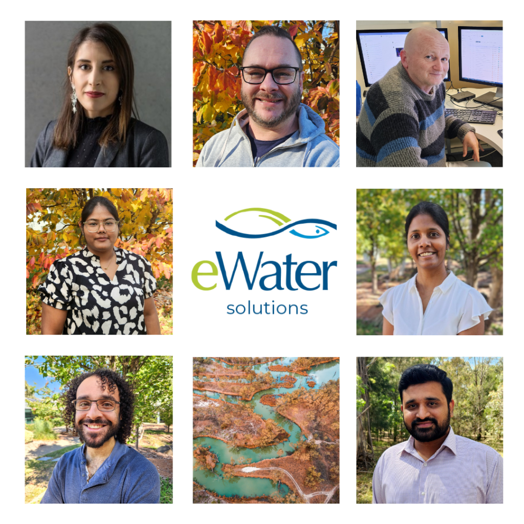
Shoutout: Celebrating our software development team
A shoutout on eWater Solutions, our software and hydrological division, and their incredible work in strengthening our systems and infrastructures
Our software development team play a critical role in delivering creative, science-based, and trusted water management tools and services. This includes ensuring strong robust, secure, and reliable systems to give our Australian government owners and stakeholders continued access to accurate and trustworthy information.
We wanted to give the team a #shoutout in recognition of their efforts in strengthening our systems and infrastructures to deliver a superior outcome in the interest of owner governments, stakeholders, and clients, and on behalf of the Australian people who have invested in the capabilities we are entrusted to deliver.
Our people have always been central to everything we do at eWater Group . They play a critical role in our commitment to the pursuit of the sustainable management of water resources through the sharing of best practices, capabilities, and knowledge nationally and globally.
Our latest and first Group Annual Report is testament to the positive impact we have had in the pursuit of the sustainable management of water resources through the sharing of best practices, capabilities, and knowledge, nationally and globally.
Our Corporate Governance team, led by Stephen Cory, MBA, GAICD, CPA, BCom, Chief Operating Officer, is critical in our organisation’s ability to make these sustainable changes in these communities.
Michael Wilson, Group CEO, eWater Group “our corporate governance team are the spine of our organisation. They have helped deliver a strong financial future for the organisation while supporting for our people, owners, partners, and clients.”
“The future of eWater Group and its people is a bright and dynamic one driven by a passionate creative, expert, and professional team.”
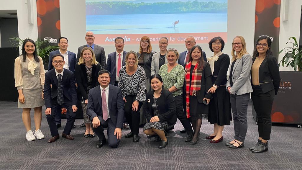
eWater Group to deliver Phase 3 of the Australian Water Partnership
eWater Group has won the contract to deliver Phase 3 of the Australian Water Partnership
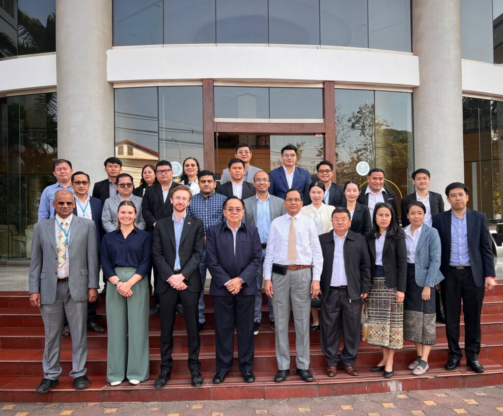
The Australian Department of Foreign Affairs and Trade (DFAT) has selected eWater Group as the Managing Contractor of Phase 3 of the Australian Water Partnership to deliver sustainable and climate resilient water resource management in the Indo-Pacific region over the next five years.
As part of an open tender process, eWater Group demonstrated its ability to deliver integrated water resource management with integrity, value and evidence-based advice and support.
eWater Group has successfully mobilised Australian water sector expertise through the Australian Water Partnership Phase 1 and 2 since 2015 which has seen AWP evolve to deliver development and partnership outcomes driven by local needs.
Michael Wilson, Group CEO, eWater Group, said “Our successful management of the Australian Water Partnership solidifies our continued commitment to support, facilitate and encourage high-quality, reliable, and evidence-based decision-making over water resources.”
“As a trusted advisor to public, private and research sector, water managers in Australia and internationally, eWater Group brings a wealth of experience implementing complex climate-resilient water resource management programs.”
eWater Group together with the Australian Water Partnership look forward to delivering a successful Phase 3 on behalf of the Australian Department of Foreign Affairs and Trade.
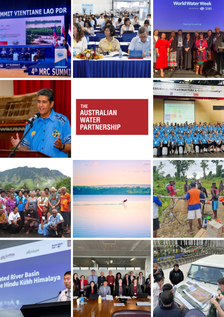
The Australian Water Partnership: Building Strong Partnerships and Engagement
Our partnerships with government, organisations, and stakeholders in Australia and internationally are crucial for eWater Group in the sustainable management of water resources.
In 2022-23, AWP, through DFAT, built strong partnerships and engagement:
🌐 AWP has supported Mekong River Commission Secretariat’s planning and analysis work on sustainable hydropower, alongside activities on drought and flood management. Australian experience on pumped storage hydropower has recently been shared with MRC colleagues.
🌐 The Indo-Pacific Water Stewardship program, which ran between 2019-2023, has had significant impacts, including an early detection to shift authority to locally-managed water stewardship organisations, with associated water stewardship leadership groups. A new activity in Vietnam has shown very strong engagement from the private sector, who see water stewardship principles as valuable as industry expands and matures.
🌐 Under the leadership of First Nations water managers from across the Indo-Pacific, AWP supported a First Nations focus at the recent World Water Week, hosted by the SIWI – Stockholm International Water Institute. Australian Indigenous water specialists have been supported to participate in range of international dialogues and conferences through AWP, ensuring water knowledge of the world’s oldest living culture is part of ongoing work on resilience to climate change.
🌐 AWP supported the Pacific Water and Wastewater Association annual conference, as well as the production of a climate resilience module for the The World Bank’s Utilities of the Future tool. Support for this key conference grew out of a close partnership between Australia and PWWA, established over many years through AWP.
🌐 Secretariat of the Pacific Community (SPC) – AWP supported surface water hydrology for flood early warning systems which has been embedded with local authorities across four pacific Islands.
🌐 AWP support two activities with International Centre for Integrated Mountain Development (ICIMOD) on regional river basin training and policy dialogue around shares waters. Results of the dialogue and research had wide reach across the Himalaya region and beyond.
We are putting a spotlight on the Australian Water Partnership’s 2022-23 achievements across the Pacific region
“The Australian Water Partnership continues to go from strength to strength in development programming, sharing knowledge and brokering partnership, and continues to advocate for sustainable and climate responsible water resource management to reduce poverty in our region,” Michael Wilson, Group CEO, eWater Group
We continue our spotlight on our divisions particularly the Australian Water Partnership as part of our latest annual report and their achievements in the Pacific community.
In 2022-23, the AWP team supported DFAT to achieve:
🌏 Papua New Guinea: Partnering with WaterAid Australia, AWP supported the development and integration of an inclusive Monitoring Information System which focuses on water scarcity, water security, climate resilient and GEDSI activities. The activity included a focus on community based WRM and WASH which was designed and rolled out in collaboration with the East Sepik Council of Women and East Sepik Disabled Person’s Agency to deliver community engagement sessions on inclusive water resource management.
🌏Partnerships for a Resilient and Climate-Smart Water Sector – Pacific and Southeast Asia – Pacific and Southeast Asia: Utility ‘twins’ were facilitated by the Australian Water Association, to build people-to-people partnerships across five countries and established relationships between AWA and other water associations in Indonesia, Solomon Islands and Vietnam.
We acknowledge and thank the Australian Department of Foreign Affairs and Trade, the Australian Water Partnership, WaterAid Australia, East Sepik Council of Women, East Sepik Disabled Person’s Agency, and the Australian Water Association.
eWater MUSIC: Our tools helping the next generation
eWater MUSIC: Harmonising nature and technology to create resilient cities
Urban Hydrologist, Mukta Sapkota, guest lectured at the University of South Australia for its Water Sensitive Design and MUSIC Modelling for Stormwater Management
Today [April 15 2024], our Senior Urban Hydrologist, Mukta Sapkota was invited as a guest lecturer to the University of South Australia for its Water Sensitive Design and MUSIC Modelling for Stormwater Management lecture where she shared her extensive expertise and knowledge on eWater MUSIC™.
eWater MUSIC™ our software tool that simulates the behaviour of stormwater in urban catchments and helps our community to understand the performance of stormwater quality treatment systems.
“It was a great privilege to be able to share best practices, capabilities and knowledge of our water management tools with students from the University of South Australia. These opportunities to share knowledge and skills are all part of our efforts to sustainably manage our precious waterways,” Mukta Sapkota said.
“I am thrilled to be sharing my expertise and knowledge in the Water Sensitive Design and MUSIC Modelling for Stormwater Management lecture. It is great opportunity to delve into sustainable urban design and modelling techniques, highlighting how we can harmonise nature and technology to create resilient cities.”
eWater MUSIC™ is used taught in 14 Australian universities and used by over 120 Australian councils, hundreds of engineering and development businesses across Australia > https://ewater.org.au/products/music/
We just wanted to say thank you to the University of South Australia and University of Adelaide which have been long-standing supporters of eWater MUSIC™ and have been teaching it to the next generation of urban planners, water engineers and urban development professionals for the past ten years.
Partnerships: Working with the South Australian Government
Michael Wilson, Group CEO, and Sarah Ransom, General Manager of the Australian Water Partnership, met with the South Australian Deputy Premier and Minister for Climate, Environment and Water, Dr Susan Close MP.
South Australia has a formidable legacy in water investment and reform including, through its partnership with eWater Group, a determination to strengthen SA’s water security approach and fully implement sustainable and integrated water resource management practices.
We are very proud of our work in South Australia through our two divisions, eWater Solutions and the Australian Water Partnership.
Both of our divisions have had a long-standing and successful partnership with the South Australian Government in providing creative, science-based, and trusted water management expertise and tools to meet its water management needs and facilitate South Australian expertise to be deployed around the world in the service of better water management and poverty reduction.
Michael Wilson, Group CEO, and Sarah Ransom, General Manager of the Australian Water Partnership, met with the South Australian Deputy Premier and Minister for Climate, Environment and Water, Dr Susan Close MP, to reiterate our continued support to the South Australian Government and its people who have invested in the capabilities we are entrusted to maintain and deliver.
“It was a great pleasure to meet again with the Deputy Premier this week and update her on eWater’s work with her Department and counterpart agencies across the country to strengthen and broaden the tools and services which strengthen quality, evidence-based decision-making over the management of Australia’s scarce and critical water resources,” said Michael Wilson, Group CEO of eWater.
“No Australian state government has done more than SA to help project Australian water management knowledge internationally, over many years. South Australia, at the end of the Murray-Darling system, has been pivotal in implementing the National Hydrological Modelling Platform, eWater Source, developed and managed by eWater Group.”
“Our meeting provided an opportunity to look at ways in which we can further develop and refine a modernised eWater Source, as well as improve our other water management tools like eWater MUSIC, in the interests of all users.”
“We also had the opportunity to discuss the SA Government’s continued strong involvement in the delivery of activities by the Australian Government’s flagship international water for development initiative, the Australian Water Partnership, and its strong and continued support for its activities in Australia and internationally.”
eWater has been involved in many successful endeavours with South Australia, delivering water management expertise, best practice, capabilities, and knowledge over the past twenty or more years.
We work to support, facilitate, and encourage high-quality, reliable, and evidence-based decision making over water resources. We do this by developing, managing, and deploying tools and services that enhance the sound and responsible management of water.
South Australia is a critical member of the eWater hydrological modelling community through its use of eWater Source and eWater MUSIC, our water sensitive urban design tool. MUSIC is used in eight Local Government areas and 29 South Australia-based firms provide MUSIC services to clients. The Department for Environment and Water and (DEW) and SA Water are active users of eWater Source.
Recently, through eWater Solutions, we worked with DEW to incorporate the Source Farm Dam plugin, making the functionality available to all eWater Source users. Farm dams influence the movement of surface water across the landscape and can slow or reduce flows to local waterways. It is important to be able to model these effects on water volume, quality, and availability in shared river systems where all users can be affected.
In areas with a high proportion of farm dams, such as rural residential areas like the Mount Lofty Ranges, these impacts can be significant. Incorporating the functionality into Source allows for a finer-scale assessment of the potential impacts of farm dams, giving water managers critical information to understand and respond to these impacts.
In addition to this project, eWater Solutions supported DEW to develop new tools to improve and simplify its model management systems and modelling outputs, in partnership DEW’s own modelling experts.
Our international development flagship, the Australian Water Partnership, managed by eWater on behalf of the Australian Department of Foreign Affairs and Trade, has been working with the South Australian Government for some years now on various activities in developing countries overseas, as well as in the organisation of national and international policy forums and awareness-raising events.
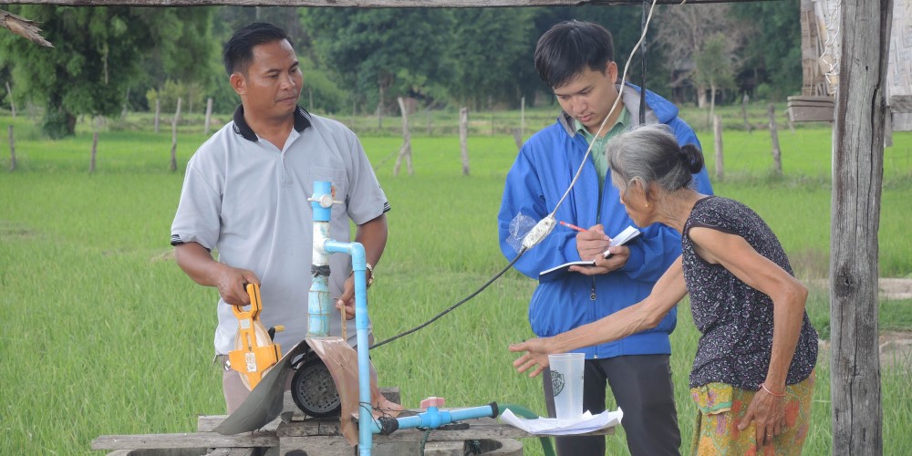
The Australian Water Partnership worked with experts from the South Australian Government on an important groundwater activity in the Lao PDR with Flinders University. These experts, who are working on groundwater management in South Australia, were able to provide valuable peer-to-peer partnership to Lao colleagues, based on how they manage the challenges within their own communities.
South Australia has long been a supportive of national and international water events such as the 2023 Australian Water Partnership Partners Workshop, which was designed with DEW, and opened by members of the Kaurna people, SA Governor Her Excellency Frances Adamson AC and SA Deputy Premier and Minister for Water, the Hon Dr Susan Close MP. The Partners Workshop offered Australian water experts a range of engaging and informative sessions to drive conversations and practical steps towards strengthening community and environmental resilience at home and overseas through taking cost-effective and evidence-based water and climate action.
We were also privileged to have the support of the SA Water Ambassador, the Hon Karlene Maywald, who has participated in several AWP activities over recent years including as a member of Australian delegations to UN Climate Change Convention COP27 and COP28, as well as the 2022 World Water Week in Stockholm.
We are profoundly proud of what we have achieved in our partnership with the South Australian Government, and we look forward to strengthening and evolving together with other Australian government and private sector partners in the pursuit of better water resource management in Australia and internationally, for the benefit of all.
Australian Water Partnership 2022-23 Achievements
Our latest annual report is our first and most comprehensive account of the strategic direction of eWater Group and its divisions, eWater Solutions and the Australian Water Partnership
The Australian Water Partnership mobilises Australia’s water resource management skills and knowledge in response to demands from partners across the Indo-Pacific on behalf of the Department of Foreign Affairs and Trade.
We are incredibly proud of the achievements of the Australian Water Partnership and are taking the opportunity to shine a light on their work over coming weeks.
Partnerships in Southeast and South Asia have made the following impacts:
Vietnam – As part of a strong and enduring partnership between Vietnam and Australia, AWP partners provided support to the drafting of a new Law on Water Resources. This included technical support along with an activity which focused on incorporating the experience of people with disability into the legislative drafting process. The new law passed the National Assembly in December 2023.
Laos – A consortium of AWP partners worked closely with the Lao Department of Water Resources, to develop maps and plans for groundwater resources, a critical resilience measure in Laos. AWP support included support for consultations where rural women’s perspectives were heard, and reflected in the groundwater management plans.
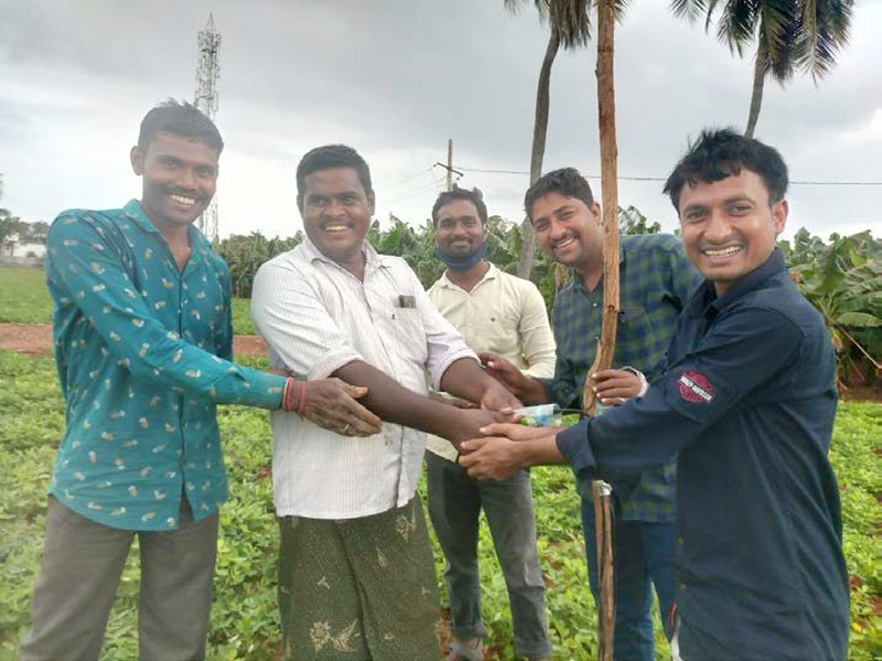
India – India and Australia have exchanged vital experience on managing drought and water scarcity, in the context of climate change. An AWP activity in Andra Pradesh developed training modules on strategic irrigation, groundwater management, analysing and acting on climate risk and optimising water use efficiency through soil microbiology. Information from this activity reached over 6000 people and is an excellent example of leveraging existing community infrastructure to maximise impact.
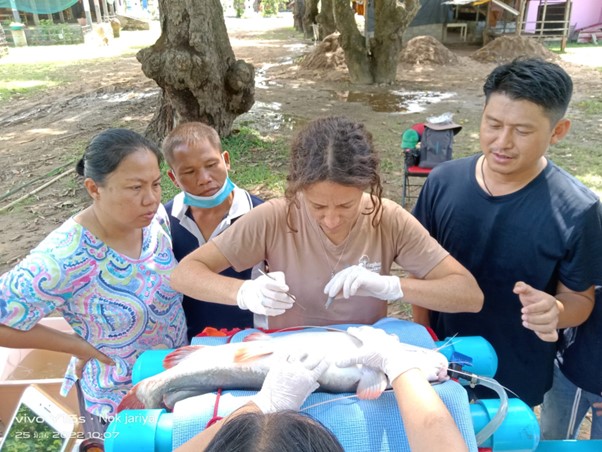
Mekong regional – The Mekong river is the world’s biggest inland fishery, but new data about fish movements and behaviours is needed in the context of extensive hydropower development. Working with local partners to support fisheries monitoring in the Mekong basin, AWP partners helped to assess impacts of mainstream hydropower projects on fish, and the people who depend on them, and ensured a strong focus on GEDSI by offering training for Lao women in fish surgery to deploy tags.
We also acknowledge and thankAither, Alluvium Group, AMPERES, Flinders University, IWMI, South Australia Department for Environment and Water, Charles Sturt University.
The National Water Initiative: Have your say
As a water management organisation, we are strong advocates in the building of water knowledge, capacity, and capabilities, especially in hydrological modelling, in Australia and internationally.
eWater Group welcomes the announcement by the Australian Government to open consultations on a future national water agreement, the National Water Initiative (NWI), and seeks the opportunity to create a more robust approach in building an efficient and sustainable water industry.
The NWI has had a significant impact on Australian water reforms over the past 20 years, including the establishment of the National Hydrological Modelling Strategy, which saw the adoption of the eWater Source as the national platform.
A more contemporary NWI will help address the future challenges Australia will face, including the continued impact of climate change on our water resources, water scarcity and sustainability. A future NWI will also see greater integration of First Nations water knowledge and elevate Indigenous voices.
We encourage our partners to be part of this consultation and make a submission by 3 May 2024. This is our opportunity to have a say on the future of sustainable water management in Australia.
eWater Limited Board farewells Director, Andrew Reynolds
eWater Limited Board farewells Director Andrew Reynolds
eWater Limited Board Director, Andrew Reynolds, announced this week at our recent board meeting his decision to step down after six years of providing advice and advocacy to the Board and eWater Group.
Michael Wilson, Group CEO said, “Andrew’s extensive experience at the Murray Darling Basin Authority has provided eWater Limited Board with invaluable insights and helped steer and strengthen our organisation in its delivery of water management solutions and how we engage with our government members and other stakeholders in Australia and internationally. As a board member and supporter of eWater Group, you have generously given your time to make tough decisions and act in the best interest of eWater, and we thank you.”
On behalf of the eWater Ltd Board and the company, Board Chair, Greg Claydon, paid tribute to and thanked Andrew for his very significant contribution to the Board over the last six years and to water management decision-making, including that informed by eWater’s products, over an even longer period.
“Andrew brought specific knowledge, experience and skills to the Board, including in water management, river and infrastructure operations, risk management and governance, building on his executive roles with the Murray-Darling Basin Authority and earlier work. These have been invaluable to informing strategic directions and approaches adopted by the company,” Greg Claydon said.
We wish Andrew all the best. We will announce a new eWater Limited Board Director shortly.
The eWater Limited Board plays a crucial role in ensuring the highest of governance and accountability standards to ensure eWater Group and its divisions continue our mission to support the environmentally sustainable management of water resources in Australia and worldwide > https://lnkd.in/g_XEZtG4.
Who are we?
Jointly owned by all Australian governments, eWater Group provides stewardship, management, development, enhancement, skills-building, research, access, and transparency in water management and modelling tools, capability, and capacity.
We do this in the interests of our government members, stakeholders, clients, and customers and on behalf of the Australian people who have invested in us.
At eWater Group, and through our divisions, eWater Solutions and the Australian Water Partnership, support governments, organisations, and water managers to use our tools and products, expertise, and international development program management capabilities, including in their pursuit of integrated water resource management objectives and poverty reduction.
Meet Dr. Emily Barbour, Australian Water Partnership
Meet Dr. Emily Barbour, Mekong Program Lead, Australian Water Partnership
The drive to find answers and new ways of working to solve complex environmental challenges has always been a key driver in Dr Emily Barbour’s career. Her curiosity and her openness to sharing her knowledge and expertise with all – her colleagues and our partners – has always been apparent, from the very beginning.
As the Australian Water Partnership’s Mekong Program Lead, Dr. Emily Barbour has been leading the way in delivering climate-resilient water policies, practices, and tools in the Mekong region since joining AWP and eWater in 2022.
Dr Barbour brings more than 15 years of prior experience working in the water sector within Australia and internationally. Her previous work as CSIRO Senior Research Scientist included co-leading the Commonwealth Environmental Water Office’s Basin-scale Monitoring and Evaluation program, which evaluates the ecological outcomes delivered by Australia’s investment in environmental water within the Murray-Darling Basin.
With a Doctor of Philosophy in Hydrology and Water Resources from the ANU, and Undergraduate degrees in Environmental Engineering and Science from the University of Newcastle, Emily has worked on water resource modelling projects in South Asia and the Pacific, chaired the CSIRO Land and Water Science Council, and taught at the University of Oxford’s within its Master of Science degree program in Water Science, Policy, and Management. She also undertook an undergraduate exchange program in Norway.
Well before she thought of joining the Australian Water Partnership, a division of the eWater Group, Emily had a strong connection to eWater as she deployed her professional expertise in water policy and scientific research with CSIRO. In her time there, Emily held a number of roles including a River System Modeller and worked on Australia’s sophisticated software-based National Hydrological Modelling Platform, eWater Source.
As Mekong Program Lead at AWP, her focus is on designing and delivering development cooperation activities on behalf of the Australian Government (through the Department of Foreign Affairs and Trade), and in partnership with international governments and institutions in the Mekong region. As part this key role, Emily is leading the way in knowledge exchange with governments which highly value Australia’s water management expertise – and our willingness to both share our experience and learn from others.
Emily has worked with our experienced AWP partners to deliver on the priorities of important partner governments in Vietnam, Thailand, Lao PDR, and Cambodia, through innovative programming, dialogue, training, deployment of tools and processes to support quality decision-making, and policy dialogue.
“I am always interested in pursuing and understanding the different perspectives of our partners and stakeholders from Australia and internationally; I believe that knowledge-building and capability development can only be successful if shared both ways.
“Through our partnership with DFAT, we have opportunities to observe and learn how our programs have impact, explore new ways to improve implementation, and identify how to respond to what we have learned in a meaningful way, which also enhances our effectiveness in the future.”
“I am interested in the interface between AWP and international governments, how they operate, how decisions are made, and what is useful [in terms of data and tools]. What we do feels like meaningful work to me and my team.”
“I am interested in how we can use data and technical tools to support higher quality, more evidence-based decision-making in water policy and management, and how this can improve the lives and opportunities of communities that rely on secure supplies of good quality water.”
Emily’s passion for water and the sector cannot be contested. Her commitment to finding solutions to working with water scarcity and promoting sustainability in water management in Australia, in the Mekong region and beyond is so clear when you hear her talk about her work.
For Emily, some of the biggest challenges facing the water sector is the need for a greater focus on working collaboratively to find practical and pragmatic solutions that can be realistically implemented, and which will be reliably maintained after the initial activity concludes. Infrastructure is only part of the solution to coping with the impacts of climate change. Often policy settings, community awareness and political will are far more important to achieving lasting success.
“Having a long-term plan is of course necessary, but also we need to consider the importance of meeting people wherever they are on their journey right now and hear their advice on how we might most usefully collaborate.”
“I believe that data and technology can be powerful when engaging with governments and institutions that demand results, but relationship-building with our partners and communities is even more important, because information-enabled solutions must be trusted and continually fine-tuned. There is such power in connection between people who are committed to learning together and trusting each other.”
From the Chair: Supporting a Refreshed National Water Initiative
Supporting a Refreshed National Water Initiative
From Greg Claydon, eWater Limited Chair and Independent Director
There has been long recognition of the importance of building knowledge, capacity and capability if we are to have an efficient and sustainable water industry in Australia. That has often been inferred and regularly stated during Australia’s water reform journey. There are likely varying views among stakeholders regarding the extent to which such recognition and importance have been underpinned by adequate resources and actions.
eWater Group regards the building of water knowledge, capacity, and capability, especially in hydrological modelling and other decision support tools, processes and products within the Australian and international professional water management community, as fundamental to our mission, subject to resource practicalities.
Australia’s Productivity Commission is currently undertaking an inquiry into the reform progress of Australia’s water resources sector. This inquiry, which follows reports of previous inquiries by the Productivity Commission in 2017 and 2020, is expected to provide advice about the progress of all Australian governments in achieving the objectives, outcomes and timelines anticipated under the 2004 Intergovernmental Agreement on a National Water Initiative (NWI) and, where practicable, on key aspects of water security for Australia.
The Productivity Commission has noted that reform of the Australian water sector has been ongoing over several decades, reflecting the fundamental importance of water to all aspects of our society and environment, and the significant challenges involved in managing a shared natural resource impacted by climate change and periods of scarcity.
Water reform at a national level accelerated in 1994 when the then Council of Australian Governments (COAG) agreed a water reform framework. That framework recognised that decision making should be determined on the best available scientific information. Although not expressly stated in the framework, it was also recognised at the time that knowledge, information and understanding about Australia’s water resources needed to improve. That was being supported through the Cooperative Research Centres program, among others, including the CRC for Catchment Hydrology (CRCCH) and the CRC for Freshwater Ecology (CRCFE).
In 2004, COAG agreed that the NWI include knowledge and capacity building as a key element to assist in underpinning implementation of the agreement. Supporting that, further requirements, identified by the earlier work of the CRCCH and the CRCFE and others, lead to the establishment of the eWater CRC in 2005. These CRCs provide the heritage for eWater Ltd, a not-for-profit (and also a “not-for-loss”!) company owned by all Australian Governments, to, among other things, be the trustee of the intellectual property developed through the investment under the CRC and other programs of well over $100 million of public money.
In 2008, COAG agreed that a National Hydrological Modelling Strategy (NHMS) was needed to support better water planning and management in Australia, including to support implementation of the NWI. A key output and product of the NHMS has been the adoption of the eWater Source hydrological modelling platform as the National Hydrological Modelling Platform (NHMP).
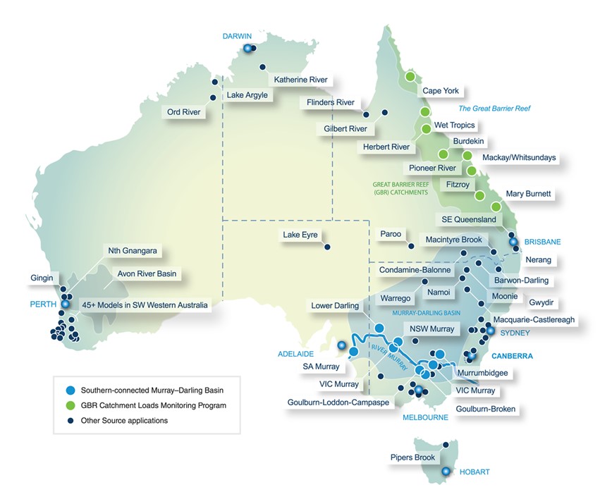
eWater Group is the custodian and manager of Source. We are also the custodian and manager of other important software-based hydrological modelling tools and services, including eWater MUSIC, the urban stormwater modelling product used by more than 120 Local Governments across Australia to support their decisions about urban developments. As a part of these roles and responsibilities, we aim to ensure the security and integrity of these tools are guaranteed and satisfy industry standards and government cybersecurity requirements.
Source, as the NHMP, has been integral to many governments’, and their agencies’ and utilities’, decision-making processes for sustainable water resources planning and management; granting of water entitlements and announcements of water allocations; assessment of water security and water infrastructure developments; and, increasingly, river and water infrastructure operations and compliance activities. These may be multi-billion-dollar decisions, so Source system performance, reliability and resilience are fundamental for it to be “fit-for-purpose”.
Source provides an integral tool to link science to help inform water policy, planning, management, operations, accounting, and compliance. Importantly, water policy, planning, management, operations, accounting, and compliance are adaptive in the Australian context. They need to be, as our population, climate, land uses, water using behaviours and community expectations and attitudes change. So too then, Source has to be adaptive, and it needs to have proper upkeep, modernisation and maintenance as a critical asset to support decision making.
Arguably, the same is true for water reform in Australia. So, in that respect, it is pleasing that the Australian Government has committed to renew the NWI. No doubt, that renewal or “refreshing” will be informed by the report of the Productivity Commission’s inquiry. Hopefully, that includes a commitment to a culture of evidence-based decision making, innovation and continuous improvement to underpin successful implementation.
Adaptive management is not possible without adequate modelling of Australia’s water resource systems and their interconnections. eWater Group wants to continue to have Source develop and evolve as the needs of our government owners, customers and communities evolve and as methodologies and technologies change and improve. Of course, to do that well requires adequate and responsible funding to meet necessary and efficient costs.
As I have mentioned previously, there are pressing imperatives to address our increasingly variable and changing climate in coherent and effective ways; to better integrate our approaches to water management, including between water quantity and water quality, surface water and groundwater; land use planning and water planning, water use and energy use, and other nexuses, recognising the water “cycle” and how water policy and programs “seep” into many other policy and program areas; and to meet cultural water provisions and the rights, needs and aspirations of First Nations people in water management. These and, no doubt, other matters will need to have a place in a renewed NWI. Similarly, to support future decision making and implementation, they should be considered integral to updating and modernising eWater’s hydrological modelling and other decision-support tools, processes and products.
It is also instructive to note that activities under the Australian Water Partnership (AWP), managed by eWater Group with funding provided by the Department of Foreign Affairs and Trade (DFAT), involve the building and sharing of knowledge about water reform through capacity building activities with regional water organisations, industry sectors and civil society, especially in the Asia-Pacific, by supporting access to Australian water reform policy, management expertise, and innovative approaches and technologies. So, how we go about water reform in Australia has implications beyond our shores. But more about the AWP in a future article.
In any event, to have an efficient and sustainable water industry, it continues to be important to invest in science and knowledge, skills and capacity and decision-support tools, processes, and products and to build capabilities in using them efficiently, effectively, equitably and respectfully. eWater Group looks forward to supporting a refreshed NWI on that basis.
Who are we?
Jointly owned by all Australian governments, eWater Group provides stewardship, management, development, enhancement, skills-building, research, access, and transparency in water management and modelling tools, capability, and capacity.
We do this in the interests of our government members, stakeholders, clients, and customers and on behalf of the Australian people who have invested in us.
At eWater Group, and through our divisions, eWater Solutions and the Australian Water Partnership, support governments, organisations, and water managers to use our tools and products, expertise, and international development program management capabilities, including in their pursuit of integrated water resource management objectives and poverty reduction.
IWD 2024: Investing in our people at eWater Group
International Women’s Day – our commitment to investing in our people to accelerate progress.
International Women’s Day is an opportunity to celebrate the advancements achieved by women in all aspects of our society over the past decades and acknowledge that more can be done to further the advancement of women and girls in Australia and globally.
More diverse workplaces are more creative, they anticipate challenges and risks better and they are by definition more inclusive: of people, ideas, and perspectives.
eWater Group and its divisions advocate and support gender equality in all aspects of water resource management, and at all levels, through our behaviours, programs, projects, and within our engagement with national and international governments, agencies, civil society, professional organisations, and the private sector.
We have made it one of our priorities to have a gender balanced and diverse workforce, including our executive leadership, senior management team, and throughout our organisation.
In the past decade we have made significant inroads:
The executive and senior leadership in 2015 were all men; today we have 66% female representation, including two general managers and senior leaders within eWater Solutions and the Australian Water Partnership.
Our senior leadership has had the most significant change. In 2015 our senior leadership was 100% male; today we now have 85% female representation across our software and hydrological teams along with our international development flagship program, the Australian Water Partnership.
This has had a flow-on effect to our wider organization – 50% female representation in 2015 has increased to 55% this year.
In 2021, all but one of eWater’s Board Directors was male. Although we have more to do to increase Board diversity, our Board is now 1/3 women.
As we continue to grow our workforce and our reach both nationally and internationally, eWater Group remains committed to accelerating the progress of women in the workforce so that all communities benefit.
Michael Wilson, eWater Group CEO, said “We believe a gender balanced and diverse workforce gives us a stronger, more creative, more insightful, higher performing team of experts dedicated to the sustainable management of water resources through the sharing of best practice, capabilities, and knowledge of Australian water expertise, globally.”
“A balanced workforce means that the communities in which we support – from the Murray Darling to the Mekong region – can be assured that we have their best interests at heart.”
Follow our channels to stay up to date on eWater Group and its divisions.
Pardha Mallipudi, Business Analyst and Scrum Master, eWater Solutions
Developing innovative and robust solutions for water management takes specialist skills and sound experience, but also a belief in the cause.
At eWater Group, our people play a critical role in our mission to deliver sustainable management of water resources through the development and sharing of best practices, capabilities, and knowledge of Australian water expertise, nationally and globally.
Our organisation is like no other. And our people are central to that.
Pardha Mallipudi is our Business Analyst and Scrum Master within our eWater Solutions division, our software and hydrological division of eWater Group.
Within eWater Solutions, we have hydrologists, software developers, sales experts, and innovators, which are custodians of Australia’s National Hydrological Modelling Platform, eWater Source™, as well as this country’s leading tool for water sensitive urban design, eWater MUSIC™.
With nine years of experience across finance, design and manufacture, and technology industries, Pardha’s love for problem-solving and data-driven decision-making drew him to becoming a business analyst.
“The pivotal moment for me was while working as technical analyst, a client facing role in SAP domain, I realised the transformative power of communication, project management, business, and data analysis and how it could drive efficiency and improve customer experience and streamline an organisation. That experience ignited my passion for business analysis and led me to pursue it as my chosen career path.”
This passion led Pardha to joining eWater Group and our eWater Solutions division in 2023. Our commitment to developing innovative solutions for water management and sustainability and environmental responsibility was the catalyst for joining our team.
“I was drawn to eWater’s mission to make a positive impact on water resources and an opportunity to align my expertise with a meaningful cause.”
As our Business Analyst and Scrum Master, Pardha plays a crucial role in stakeholder management, data analysis, process improvement, and strategy development to support the organisation’s mission.
“At eWater, there isn’t a typical day, as the nature of our work varies depending on ongoing projects and initiatives. One example of my role was when I worked with the team to overhaul the existing development tools. This helped as a team collaboration exercise and getting to know each individual’s interests and areas of expertise, which we then took to our external stakeholders. Seeing this translate to our owners and partners was fantastic.”
It is Pardha’s optimistic attitude and self-starter approach to work which has been a positive life force within our organisation and instrumental in our transformation journey that eWater Group is undergoing.
“The organisation’s reach in the field of sustainable water resource management is substantial, with a strong commitment to innovation and collaboration. I believe eWater Group has the potential to make a significant and lasting impact on the global water management landscape.”
It is the policies and program that govern Australian and the international water management decisions that remains a real challenge for eWater Group, water industry as well as governments, worldwide.
The key to our success is the need to learn to adapt and evolve environmental conditions, improve data collection and analysis, ensure effective communications with stakeholders but also enhance the performance of our applications and align them to current trends.
“To overcome these challenges, we can invest in advanced analytics tools, establish strong partnerships with stakeholders, and focus on continuous improvement in our processes and technology, and just as important, encourage staff to upskill to meet the changing needs of our environment and stakeholders.”
And it’s this attitude and approach that makes Pardha Mallipudi, eWater Business Analyst and Scrum Master, a crucial member of our organisation.
Who are we?
Jointly owned by all Australian governments, eWater Group provides stewardship, management, development, enhancement, skills-building, research, access, and transparency in water management and modelling tools, capability, and capacity.
We do this in the interests of our government members, stakeholders, clients, and customers and on behalf of the Australian people who have invested in us.
At eWater Group, and through our divisions, eWater Solutions and the Australian Water Partnership, support governments, organisations, and water managers to use our tools and products, expertise, and international development program management capabilities, including in their pursuit of integrated water resource management objectives and poverty reduction.
Meet Dr. Melina Vidoni, eWater Solutions
Dr. Melina Vidoni, Software Development Lead, eWater Solutions
“I am a big believer in fostering collaboration and empowering and pushing my team to be more responsive and agile to changes in the market and customer needs with a great emphasis on collaboration across our developers, research software engineers and hydrologists.”
We are excited about the future of eWater Group. We are continuing our commitment to the pursuit of sustainable management of water resources through the sharing of best practices, capabilities, and knowledge of Australian water expertise nationally and internationally.
And through this, we have made significant investments in the skills and expertise within our software development and hydrological division, eWater Solutions, which is responsible for Australia’s National Hydrological Modelling Platform, eWater Source, as well as our other software tools, such as eWater MUSIC.
Our organisation is a high-calibre team of software developers, hydrologists, academics, sales and project managers, public policy and water industry experts will enable us to continue to meet the needs of our Australian and international owners, partners, and stakeholders.
As our Software Development Lead for the software and hydrological division of eWater Group, Dr Melina Vidoni brings an extraordinary breadth of technical and academic experience to our organisation, including extensive experience in technical debt identification and repayment strategies.
For those not in the know, originally coined by Ward Cunningham in 1992, an American computer programmer, technical debt was considered to be the result of software developers choosing a low-quality solution due to time constraints, wanting a faster or earlier release. This definition evolved over time, and by 2010 it was acknowledged that over 16 types of Technical Debt existed (Alves et al., 2014) including process, people, requirements, and architecture debt, among others.
Nowadays, and taking a step further towards understanding technical debt in organisations’, Gartner’s definition posits that technology debt is the outstanding amount of money an organisation must spend on digital technology cost obligations to continue doing business, and the incremental burden of shortcuts caused due budget or managerial decisions.
This definition later evolved to include the decisions of all those who are somehow involved in software and, as researchers on the Software Engineering Institute demonstrated, can be highly affected by external, contextual factors.
Melina graduated from the Universidad Tecnologica Nacional (UTN) in Santa Fe, Argentina as an Information Systems Engineer before receiving her PhD, summa cum laude, at the same institution. After completing her PhD, Melina moved to Australia to pursue an academic career and gain international experience, including Lecturer at the Australian National University in the CEC School of Computing, where she specialised in technical debt identification and repayment strategies.
Melina’s career at the Australian National University enabled her to foster her international collaborations with researchers from around the world, including Canada and Australia. It is this interest in technical debt and the development of scientific software that led her to eWater Group.
During one of her searches for internship positions for her research students, and possible partners interested in research translation, Melina found eWater Group.
“I have always been very keen on applicable, hands-on research outputs that could benefit the industry – and that led me to start collaborating with a number of companies seeking to host scientific software, or to perform an agile transformation, acquiring over 12 years of research translation and coaching experience.”
“I was taken by the reach of eWater Source – Australia’s National Hydrological Modelling Platform. It is, by far, one-of-its-kind in terms of size, influence, and its immeasurable impact to foster and support data-driven, science-derived decision-making across Australia’s Government.”
“Being able to work with eWater, the custodians of a unique and powerful research-derived software, presents both an intellectual challenge (given my areas of research), but also a way to make a clear impact in the world – the sustainable and responsible management of water resources will benefit the entirety of Australia.
“eWater Solutions has a critical role to play in the current landscape of climate change and resilience, and the intrinsic need for humankind to protect its natural resources.”
Since starting at eWater Group in June last year, Melina has had a positive and significant impact on the eWater Solutions team through her commitment to creating a culture of continuous improvement and collaboration, with the stakeholder at its centre.
“I am a big believer in fostering collaboration and empowering and pushing my team to be more responsive and agile to changes in the market and customer needs with a great emphasis on collaboration across our developers, research software engineers and hydrologists.”
“In our work with our owners, partners and stakeholders, it is critical we continue to adapt our software products to modern times, while continuing to provide operational excellence, as well as fostering and nourishing the reliability of our products.”
Melina’s leadership within the eWater Solutions team, and wider eWater Group, is part of our continued commitment to innovate and strengthen our impact in Australia and internationally. This includes the role artificial intelligence plays in research software and water modelling, and of course the science and technology industry.
“In various areas of science, artificial intelligence is being used to analyse massive amounts of data, automate routine tasks, and make new discoveries that would have been unimaginable a few years ago.”
“AI is being increasingly integrated into scientific discovery, and so far, AI approaches have proven useful to accurately model complex, non-linear hydrological processes, to cross imaging data sources with data from sensing tools, always leveraging the power of the Internet of Things (IoTs) (Chang et al., 2023).”
“Deep learning has been successfully used to project the production and consumption of resources and deal with the increased demand (Raya-Tapia et al., 2023), to identify crop water stress (Chandel et al., 2021), and across multiple areas of the hydrological modelling, including urban water security, prediction of physical processes, and smart-city water management (Allen-Dumas et al., 2021).”
“eWater and AWP are at the forefront of hydrological modelling in Australia. I could not think of any organisation better positioned than us to spearhead the translation of fresh, novel research into usable systems that will empower decision-makers to rely on trustable, sound science.”
Jointly owned by all Australian governments, eWater Group provides stewardship, management, development, enhancement, skills-building, research, access, and transparency in water management and modelling tools, capability, and capacity.
We do this in the interests of our government members, stakeholders, clients, and customers and on behalf of the Australian people who have invested in us.
eWater Group, and through our divisions, eWater Solutions and the Australian Water Partnership, support governments, organisations, and water managers to use our tools and products, expertise, and international development program management capabilities, including in their pursuit of integrated water resource management objectives and poverty reduction.
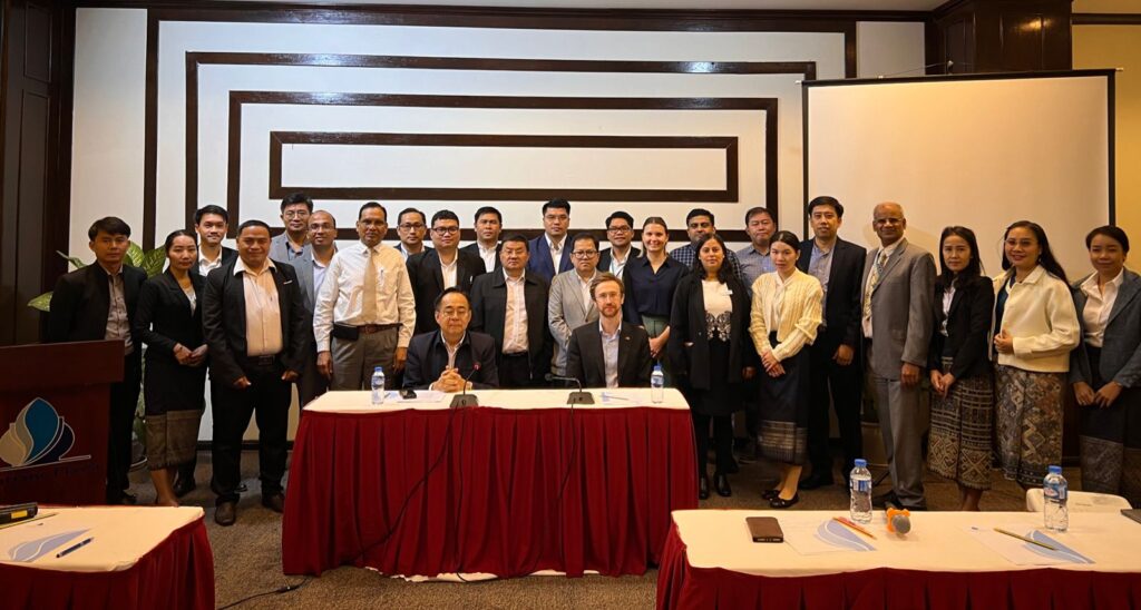
Australia and the Asian Institute of Technology collaborate with Lao PDR on water modelling
Australia and the Asian Institute of Technology collaborate with Lao PDR on water modelling
This week, officials from the Lao People’s Democratic Republic are working with modelling experts from Australia and the Asian Institute of Technology to exchange knowledge on how water modelling can be used to build climate resilience.
Both Australia and Lao PDR share the challenge of high variability in available water, despite the seasonality of water availability being very different in the two countries. Modelling provides one mechanism for understanding existing water availability and use, and how this may change into the future.
Experts from Western Sydney University, the Asian Institute of Technology, National University of Laos, and eWater Solutions are providing training in water modelling, data analysis, and equitable water management. Led by Western Sydney University’s Dharma Hagare, the training draws on the experience and understanding of water management in Lao PDR through co-delivering with knowledge brokers from the Department of Water Resources and Lao National Mekong Committee Secretariat.
Funded by the Australian Government’s Department of Foreign Affairs and Trade through the Australian Water Partnership, the training comes at an important time with Lao PDR’s Ministry of Natural Resources and Environment currently delivering on its mandate to develop river basin plans across the country.
One of the models included in the training is the Australian eWater Source model at the direct request from the Government of Lao PDR. eWater Source is Australia’s National Hydrological Modelling Platform, which supports utilisation of available data and best practice science to support water management and planning.
Mukta Sapkota, Hydrologist, eWater Solutions, helped run a customised training program focusing on the applications of eWater Source in Laos.
“These training sessions in water modelling are crucial to assisting Lao PDR’s water departments. They are an essential tool for planners and decision-makers for planning and developing resilient and sustainable infrastructure, taking into consideration future flood risks associated with changing climate as well as projected development of irrigation and hydropower, expansion of urban areas, population, and land use changes,” Ms. Sapkota said.
“By using water modelling tools, like eWater Source, local water managers can develop a more informed understanding of current and future river basin flows and water availability to guide infrastructure development and the supply of water for agriculture and energy generation.”
The training is an important component of the broader collaboration between the Government of Lao PDR and Australia, and we were delighted to have participants from within Lao Ministry of Natural Resources and Environment, including the Department of Water Resources, Department of Hydrology and Meteorology, Lao National Mekong Committee Secretariat, and the National University of Laos.
Laura Beckwith, Mekong Coordinator, Australian Water Partnership, said “AWP seeks to build partnerships between Australian technical experts and partners in the Asia Pacific to facilitate this type of knowledge exchange.”
“This shared learning about successes and challenges related to water management in Australia and the Mekong, strengthens… [our collective] ability to deliver on the sustainable and resilient management of water resources, in the context of climate change.”