River basins and catchments are complex and dynamic systems.
They cover vast areas and have a variety of landforms, ecosystems, climates, soil and rock types and land uses. They are constantly changing; from drought to wet conditions, forest to farmland, rural to urban uses.
eWater tools help catchment and river basin managers understand the total water balance, water quality and how water moves across the landscape. Giving you the power to answer fundamental management questions, including:
- What happens to water quality and quantity if land use changes or there is a bushfire?
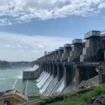
- How might new water infrastructure, such as dam, change water flows?
- What catchment improvement actions will best protect water quality and where are the priority areas for investment?
Our hydrologists empower you to build, maintain and enhance catchment and river system models that underpin sustainable management.
Case Studies

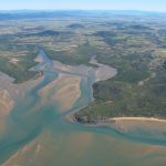
Understanding the water resources of the Ayeyarwady Basin, Myanmar
The Ayeyarwady River is Myanmar's largest and most commercially important river but its water resources are not well understood. With ...
Paddock to Reef – Integrated Monitoring, Modelling and Reporting Program
Targeting investment to improve the health of the Great Barrier Reef. What is the Paddock to Reef program? The Paddock ...
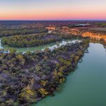
How Source supports the management of the Murray-Darling Basin
The Murray–Darling Basin is the largest and most complex river system in Australia. It runs through four States and one ...
River Basin Models and Water Sharing Policy in the upper Godavari Sub-Basin, Maharashtra, India
Resolving tension between farmers upstream and downstream over water allocations in the upper Godavari River in Maharashtra was the focus ...